MyTopo
Moorhead Mississippi US Topo Map
Couldn't load pickup availability
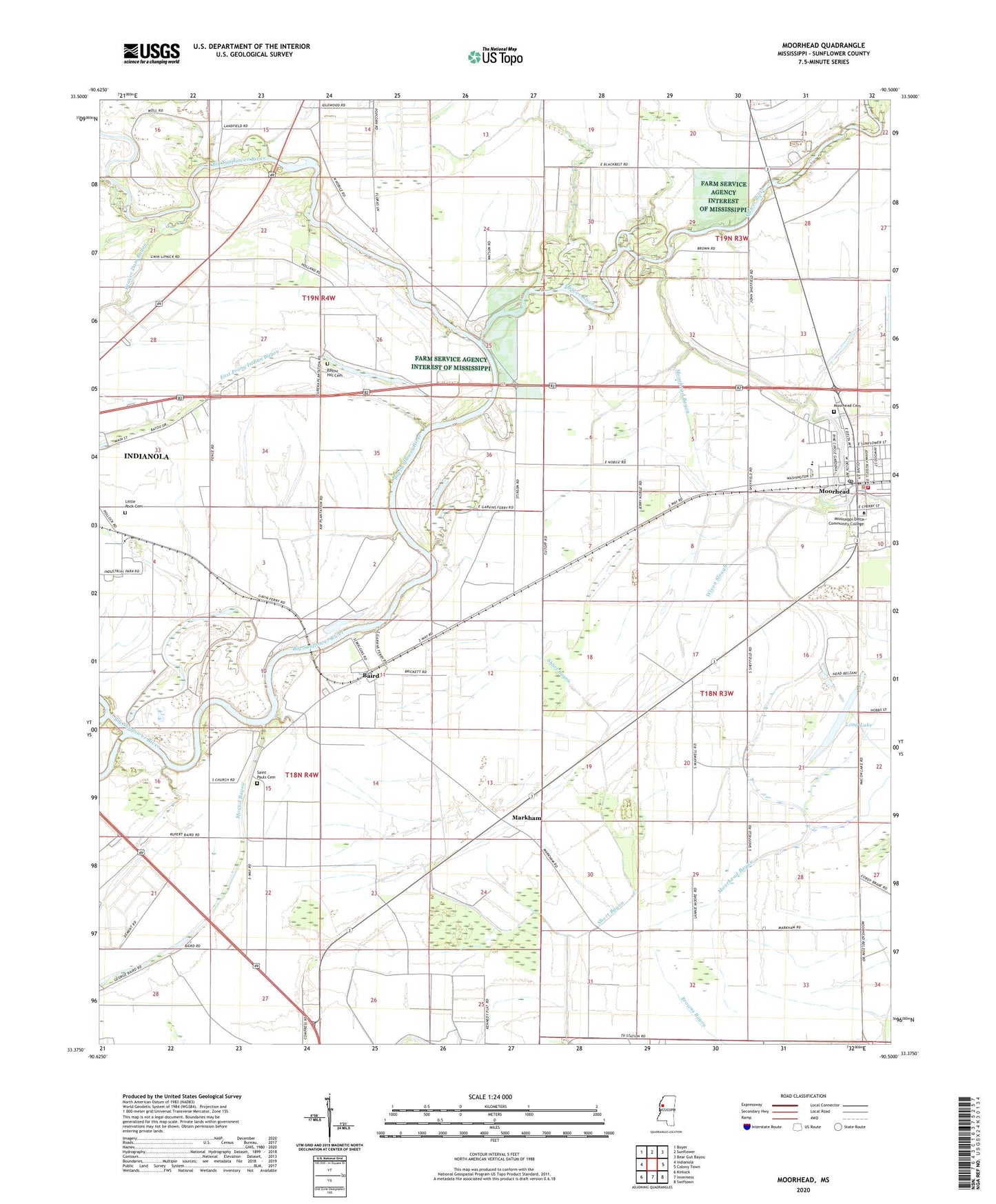
2024 topographic map quadrangle Moorhead in the state of Mississippi. Scale: 1:24000. Based on the newly updated USGS 7.5' US Topo map series, this map is in the following counties: Sunflower. The map contains contour data, water features, and other items you are used to seeing on USGS maps, but also has updated roads and other features. This is the next generation of topographic maps. Printed on high-quality waterproof paper with UV fade-resistant inks.
Quads adjacent to this one:
West: Indianola
Northwest: Boyer
North: Sunflower
Northeast: Bear Gut Bayou
East: Colony Town
Southeast: Swiftown
South: Inverness
Southwest: Kinlock
This map covers the same area as the classic USGS quad with code o33090d5.
Contains the following named places: A P B Incorporated Lake Dam, Baird, Baird School, Bayou Hill Cemetery, Beaver Dam Bayou, Bobby Duncan Lake Dam, City of Moorhead, Crahen, East Moorhead Elementary School, East Side Church, Galalee Church, Garvins Ferry, Hervey Chapel, Jenkins Lake, Johnsons Landing, Johnsonville, Lake Chaplion Church, Little Rock Cemetery, Little Rock Church, Long Lake, Marble Hill Church, Markham, Markham Church, McDaniels, McDaniels Chapel, Moorhead, Moorhead Bayou, Moorhead Cemetery, Moorhead Elementary School, Moorhead Fire Department, Moorhead Police Department, Moorhead Post Office, Mount Olive Church, New Hope Church, Pollock, Porter Bayou, Quiver River, Rock of Ages Church, Saint James Church, Saint Luke Church of God in Christ, Saint Paul Church, Saint Pauls Cemetery, Shady Grove Church, Shady Grove School, Sunrise Church, Swan Lake Church, Three Oak Church, Travelers Rest Church, Turkeyfoot Brake, Union Grove Church, WABG-TV (Greenwood), Wixon Slough, WMAO-TV (Greenwood)