MyTopo
Brownsville Mississippi US Topo Map
Couldn't load pickup availability
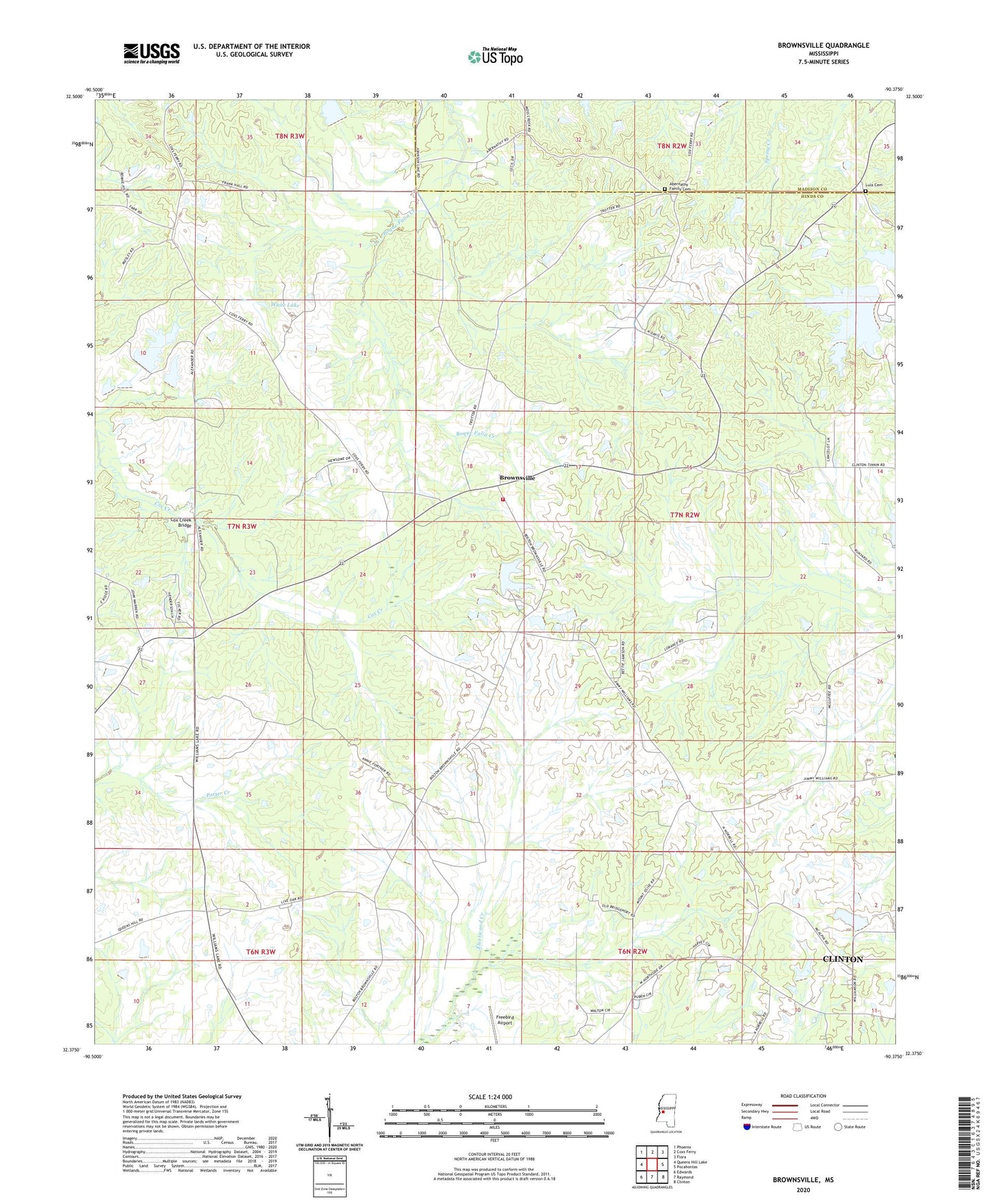
2024 topographic map quadrangle Brownsville in the state of Mississippi. Scale: 1:24000. Based on the newly updated USGS 7.5' US Topo map series, this map is in the following counties: Hinds, Madison. The map contains contour data, water features, and other items you are used to seeing on USGS maps, but also has updated roads and other features. This is the next generation of topographic maps. Printed on high-quality waterproof paper with UV fade-resistant inks.
Quads adjacent to this one:
West: Queens Hill Lake
Northwest: Phoenix
North: Coxs Ferry
Northeast: Flora
East: Pocahontas
Southeast: Clinton
South: Raymond
Southwest: Edwards
This map covers the same area as the classic USGS quad with code o32090d4.
Contains the following named places: Abernathy Family Cemetery, Brownsville, Brownsville Church, Brownsville Lookout Tower, Brownsville Volunteer Fire Department Station 1, Cox Creek Bridge, Fleetwood, G W Trotter Lake Dam, G W Trotters Lake Dam, Hill of Zion Church, Irby Lake Dam, J B White Lake Dam, J B White Pond Dam, Lula Cemetery, Lula Church, Mount Olive Church, Mount Zion Church, Nick Dennery Lake Dam, Orange Hill Church, Orangeville, Pilgrim Rest Church, Science Hill School, Supervisor District 2, Trotters Lake Dam, Wells Grove Church, West Ditch, White Lake, Williams Lake, Williams Lake Dam, ZIP Code: 39041