MyTopo
Edwards Mississippi US Topo Map
Couldn't load pickup availability
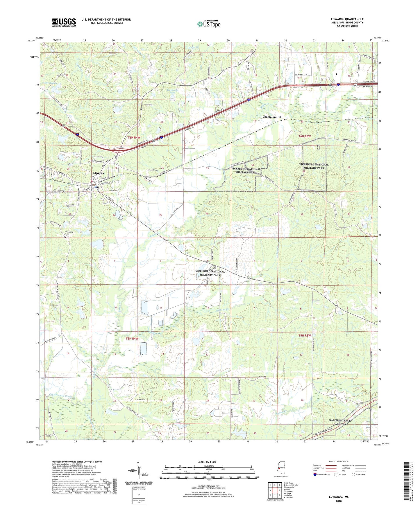
2020 topographic map quadrangle Edwards in the state of Mississippi. Scale: 1:24000. Based on the newly updated USGS 7.5' US Topo map series, this map is in the following counties: Hinds. The map contains contour data, water features, and other items you are used to seeing on USGS maps, but also has updated roads and other features. This is the next generation of topographic maps. Printed on high-quality waterproof paper with UV fade-resistant inks.
Quads adjacent to this one:
West: Bovina
Northwest: Oak Ridge
North: Queens Hill Lake
Northeast: Brownsville
East: Raymond
Southeast: Terry NW
South: Learned
Southwest: Cayuga
Contains the following named places: Adams Egg Farm Dam, Armstrong Pond, Askew Pond Dam, Bakers Creek, Ballard School, Beech Hill School, Champion Hill, Champion Hill Church, Davis Lakes Dam, Dowing Pond, Edwards, Edwards Attendence Center, Edwards Cemetery, Edwards Post Office, Edwards Town Police Department, Fairchilds Mill, Floyd Pond Dam, Friendship Cemetery, Galilee Church, Goode School, Jackson Creek, L Nobels Lake Dam, Lake Adanac, Lake Advance Dam, Little Zion Church, McClendon Pond Dam, Mount Moriah Church, Mount Moriah School, Mount Shiloh Church, Mount Zion Church, Nobles Lake Dam, Nortrust Farm Management Dam, Pilgrim Rest Church, Pleasant Hill Church, Ratliff Chapel, Ray Canada Lake Dam, Saint James Church, Saint Jeans School, Sand Hill Church, Sand Hill School, Town of Edwards, Vance Lake Dam, West Hinds Volunteer Fire Department, Williams School, WQMV-FM (Vicksburg), ZIP Code: 39066