MyTopo
Fitler Mississippi US Topo Map
Couldn't load pickup availability
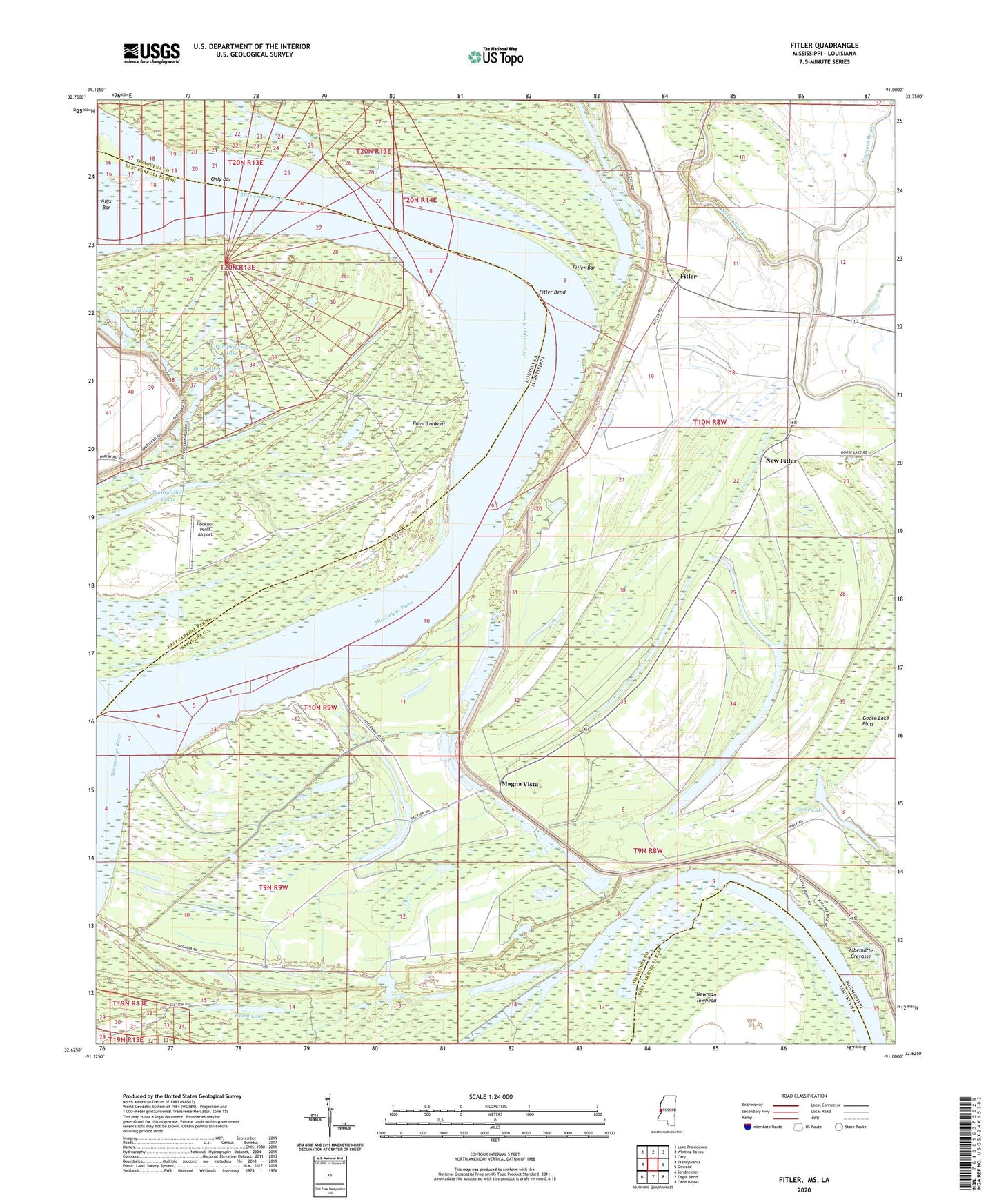
2020 topographic map quadrangle Fitler in the states of Mississippi, Louisiana. Scale: 1:24000. Based on the newly updated USGS 7.5' US Topo map series, this map is in the following counties: Issaquena, East Carroll. The map contains contour data, water features, and other items you are used to seeing on USGS maps, but also has updated roads and other features. This is the next generation of topographic maps. Printed on high-quality waterproof paper with UV fade-resistant inks.
Quads adjacent to this one:
West: Transylvania
Northwest: Lake Providence
North: Whiting Bayou
Northeast: Cary
East: Onward
Southeast: Cane Bayou
South: Eagle Bend
Southwest: Sondheimer
Contains the following named places: Ajax Bar, Albemarle Crevasse, Albemarle Lake, Bass Lake, Blue Hole, Burnleys Plantation, Cammacks Landing, Caulfield Plantation, Christina Plantation, Concord Lake, Cottonwood Landing, Cottonwood Plantation, Cottonwood Revetment, Fitler, Fitler Bar, Fitler Bend, Fitler Lake, Fitler Revetment, Fivemile Lake, Glory Lake, Goose Lake, Goose Lake Flats, Hay Landing, Ingomar, Lookout Point Airport, Magna Vista, Mount Tabor Church, Nelson Plantation, New Fitler, Newsom Bayou, Only Bar, Parks Plantation, Pleasant Green Church, Point Lookout, Point Lookout Dikes, Point Lookout Landing, Pumpkinseed Lake, Saint Matthews Church, Shiloh Landing