MyTopo
Transylvania Louisiana US Topo Map
Couldn't load pickup availability
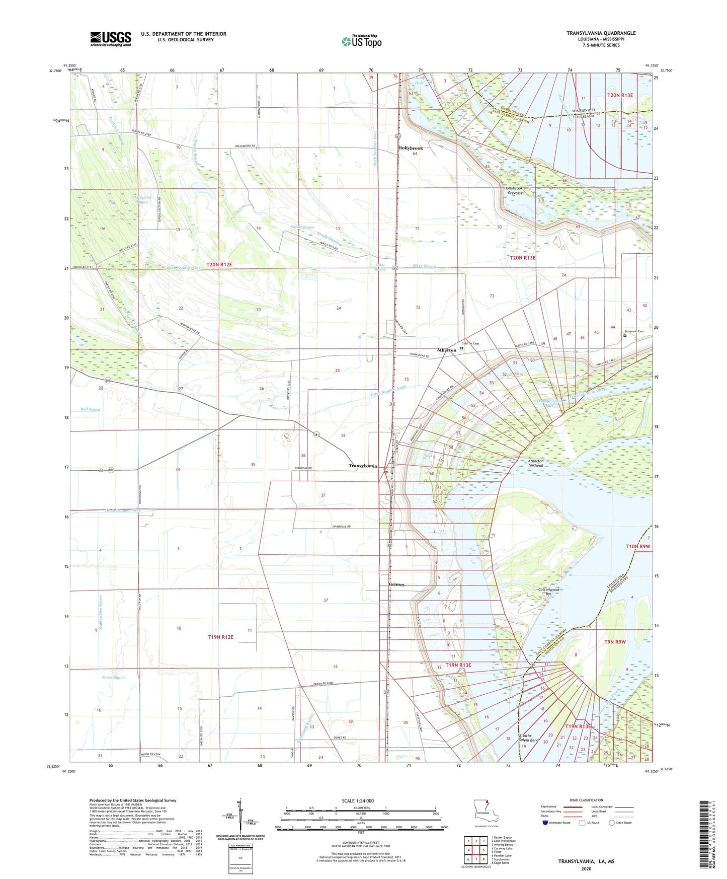
2024 topographic map quadrangle Transylvania in the states of Louisiana, Mississippi. Scale: 1:24000. Based on the newly updated USGS 7.5' US Topo map series, this map is in the following counties: East Carroll, Issaquena. The map contains contour data, water features, and other items you are used to seeing on USGS maps, but also has updated roads and other features. This is the next generation of topographic maps. Printed on high-quality waterproof paper with UV fade-resistant inks.
Quads adjacent to this one:
West: Caraway Lake
Northwest: Baxter Bayou
North: Lake Providence
Northeast: Whiting Bayou
East: Fitler
Southeast: Eagle Bend
South: Sondheimer
Southwest: Panther Lake
Contains the following named places: Alsatia-Salem Bend, Arcadia, Arcadia Landing, Arcadia Point, Atherton, Atherton Towhead, Batton Airstrip, Benjamin Cemetery, Boggy Bayou, Church of Christ, Cold Tar Cemetery, Cottonwood Bar, Ditch Number Eight, Ditch Number Four, Ditch Number Nine, Ditch Number One, Duckpond Bayou, East Carroll Parish, Goodrich Post Light, Grimes, Hollybrook, Hollybrook Crevasse, Melbourne Church, Melbourne Plantation, Melville Plantation, Morningstar Church, Mound Chapel, Mount Zion Church, Otter Bayou, Parish Governing Authority District 2, Pleasant Green Church, Sandy Bayou, Stump Hole, Transylvania, Transylvania Chute, Transylvania Elementary School, Transylvania Post Office, Ward Two, Wilman, ZIP Code: 71286