MyTopo
Fords Creek Mississippi US Topo Map
Couldn't load pickup availability
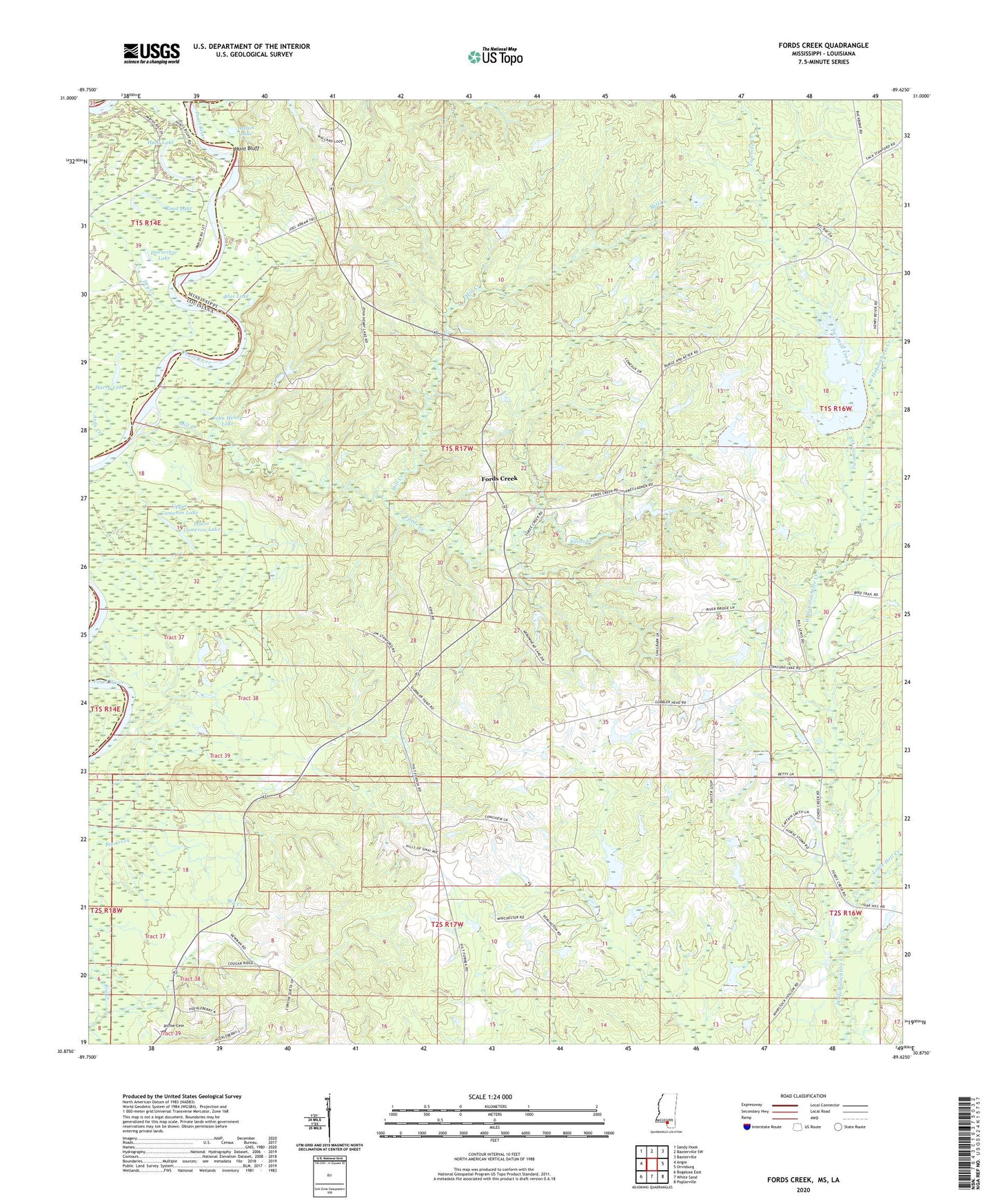
2020 topographic map quadrangle Fords Creek in the states of Mississippi, Louisiana. Scale: 1:24000. Based on the newly updated USGS 7.5' US Topo map series, this map is in the following counties: Pearl River, Washington, Marion. The map contains contour data, water features, and other items you are used to seeing on USGS maps, but also has updated roads and other features. This is the next generation of topographic maps. Printed on high-quality waterproof paper with UV fade-resistant inks.
Quads adjacent to this one:
West: Angie
Northwest: Sandy Hook
North: Baxterville SW
Northeast: Baxterville
East: Orvisburg
Southeast: Poplarville
South: White Sand
Southwest: Bogalusa East
Contains the following named places: Aaron Lake, Amackertown Volunteer Fire Department Station 2, Big Branch, Bill Williams Lake Dam, Blue Lake, Camerons Ferry, Fords Creek, Fords Creek Church, Harry Lake, Horseshoe Lake, Hunt Bluff, Hunt Lake, James O Ladner Lake Dam, John Henry Lake, Little Hell Creek, Lower Cameron Lake, Mill Creek, Richie Cemetery, Road Lake, Ronald French Lake Dam, Stewart School, Twomile Creek, Upper Cameron Lake, Wesley Chapel, White Chapel