MyTopo
Orvisburg Mississippi US Topo Map
Couldn't load pickup availability
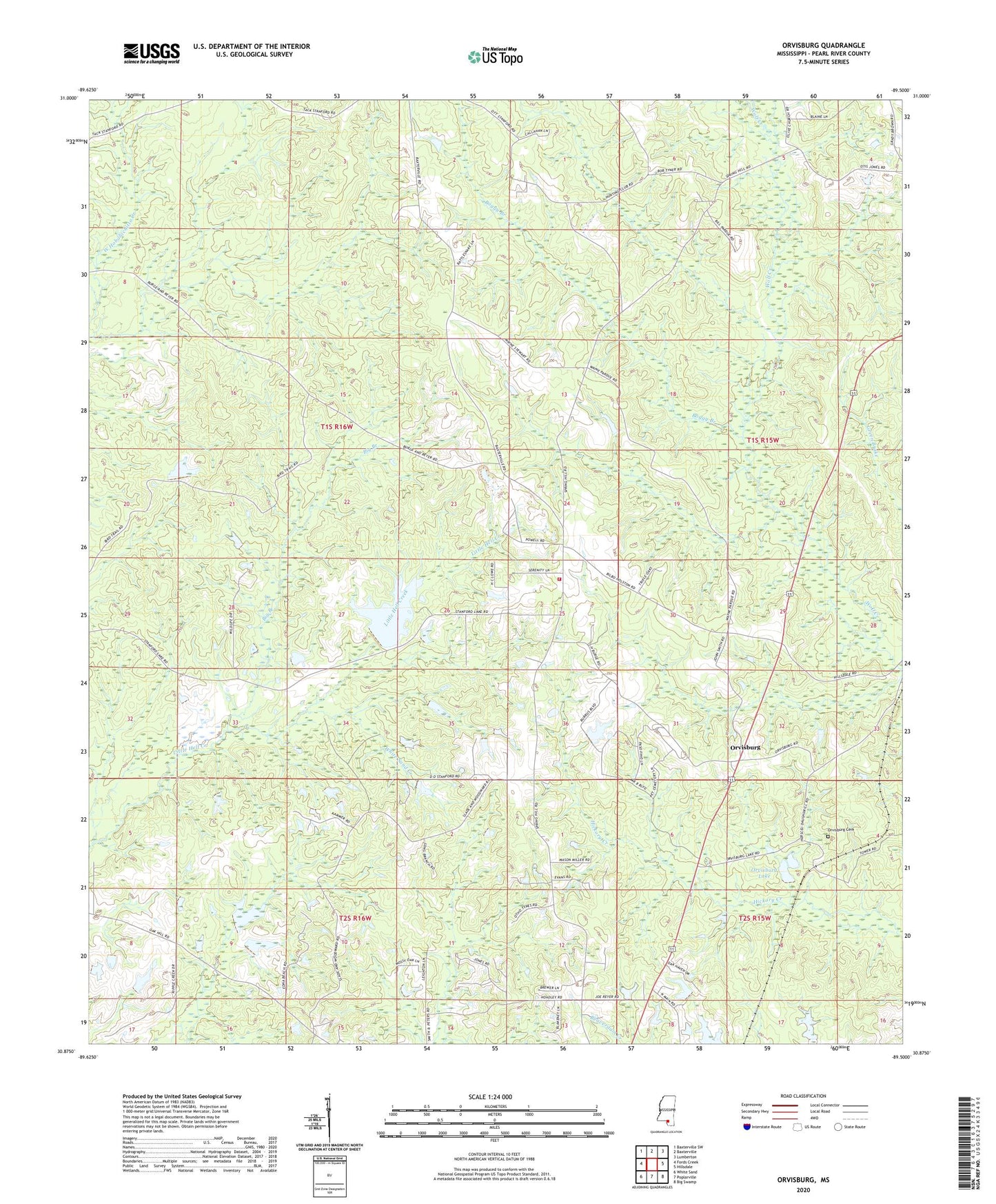
2024 topographic map quadrangle Orvisburg in the state of Mississippi. Scale: 1:24000. Based on the newly updated USGS 7.5' US Topo map series, this map is in the following counties: Pearl River. The map contains contour data, water features, and other items you are used to seeing on USGS maps, but also has updated roads and other features. This is the next generation of topographic maps. Printed on high-quality waterproof paper with UV fade-resistant inks.
Quads adjacent to this one:
West: Fords Creek
Northwest: Baxterville SW
North: Baxterville
Northeast: Lumberton
East: Hillsdale
Southeast: Big Swamp
South: Poplarville
Southwest: White Sand
This map covers the same area as the classic USGS quad with code o30089h5.
Contains the following named places: Big Branch, Bill Watson Lake Dam, Boggy Branch, Doctor A T Goodwin Lake Dam, Doctor W M Pounds Lake Dam, Loyal School, North Central Volunteer Fire Department Station 1 Headquarters, Olive Church, Orvisburg, Orvisburg Cemetery, Orvisburg Lake, Orvisburg Lake Dam, Spring Hill Church, Spring Hill Lookout Tower, Stanford Lake Dam