MyTopo
Frees Corners Mississippi US Topo Map
Couldn't load pickup availability
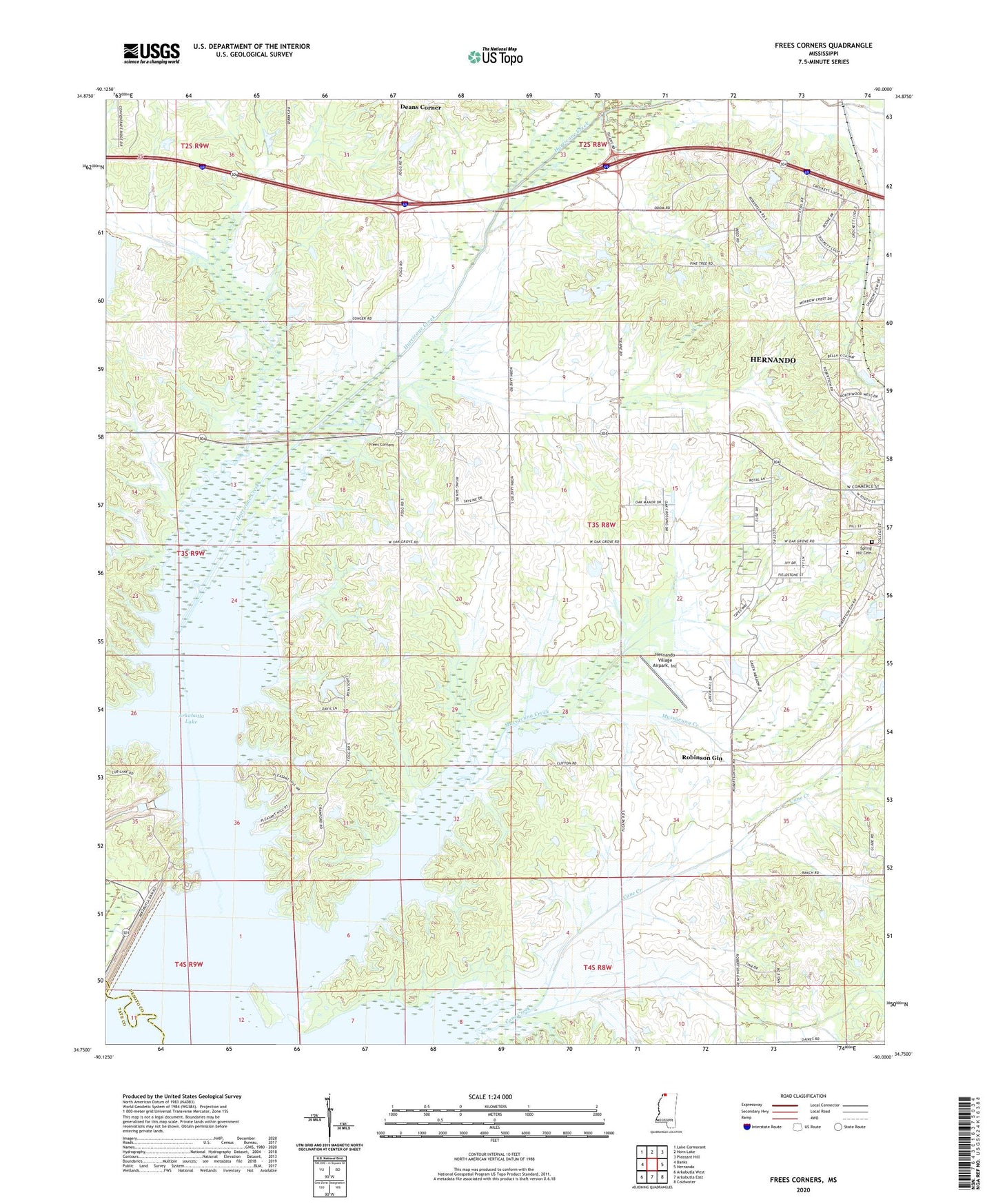
2024 topographic map quadrangle Frees Corners in the state of Mississippi. Scale: 1:24000. Based on the newly updated USGS 7.5' US Topo map series, this map is in the following counties: DeSoto, Tate. The map contains contour data, water features, and other items you are used to seeing on USGS maps, but also has updated roads and other features. This is the next generation of topographic maps. Printed on high-quality waterproof paper with UV fade-resistant inks.
Quads adjacent to this one:
West: Banks
Northwest: Lake Cormorant
North: Horn Lake
Northeast: Pleasant Hill
East: Hernando
Southeast: Coldwater
South: Arkabutla East
Southwest: Arkabutla West
This map covers the same area as the classic USGS quad with code o34090g1.
Contains the following named places: Arkabutla Dam, Arkabutla State Waterfowl Refuge, Banks Land and Cattle Company Pond Dam, Bill Wallace Lake Dam, Cane Creek, Frees Corners, Hernando Sewage Lagoon Dam, Hernando Village Airpark Inc, Hurricane Creek, J A Whitten Lake Dam, J F Conger Pond Dam, M J Simmons Pond Dam, McKays, Mussacuna Creek, N B Gray Pond Dam, North Abutment Public Use Area, Oak Grove Central Elementary School, Oak Grove Church, Oliver Chapel, Panther Creek, Plantation Point Public Use Area, Pleasant Hill, Pleasant Hill Church, Pleasant Hill Public Use Area, R E Selph Pond Dam, Robinson Gin, Saint Marys Church, Saint Marys School, Spring Hill Cemetery, Sunrise Church, Sunrise School, Supervisor District 4, Tom Clifton Pond Dam, Wolf Creek, Zion Hill Church, Zion Hill School, Zion Number 2 Church, ZIP Code: 38632