MyTopo
Gravel Hill Mississippi US Topo Map
Couldn't load pickup availability
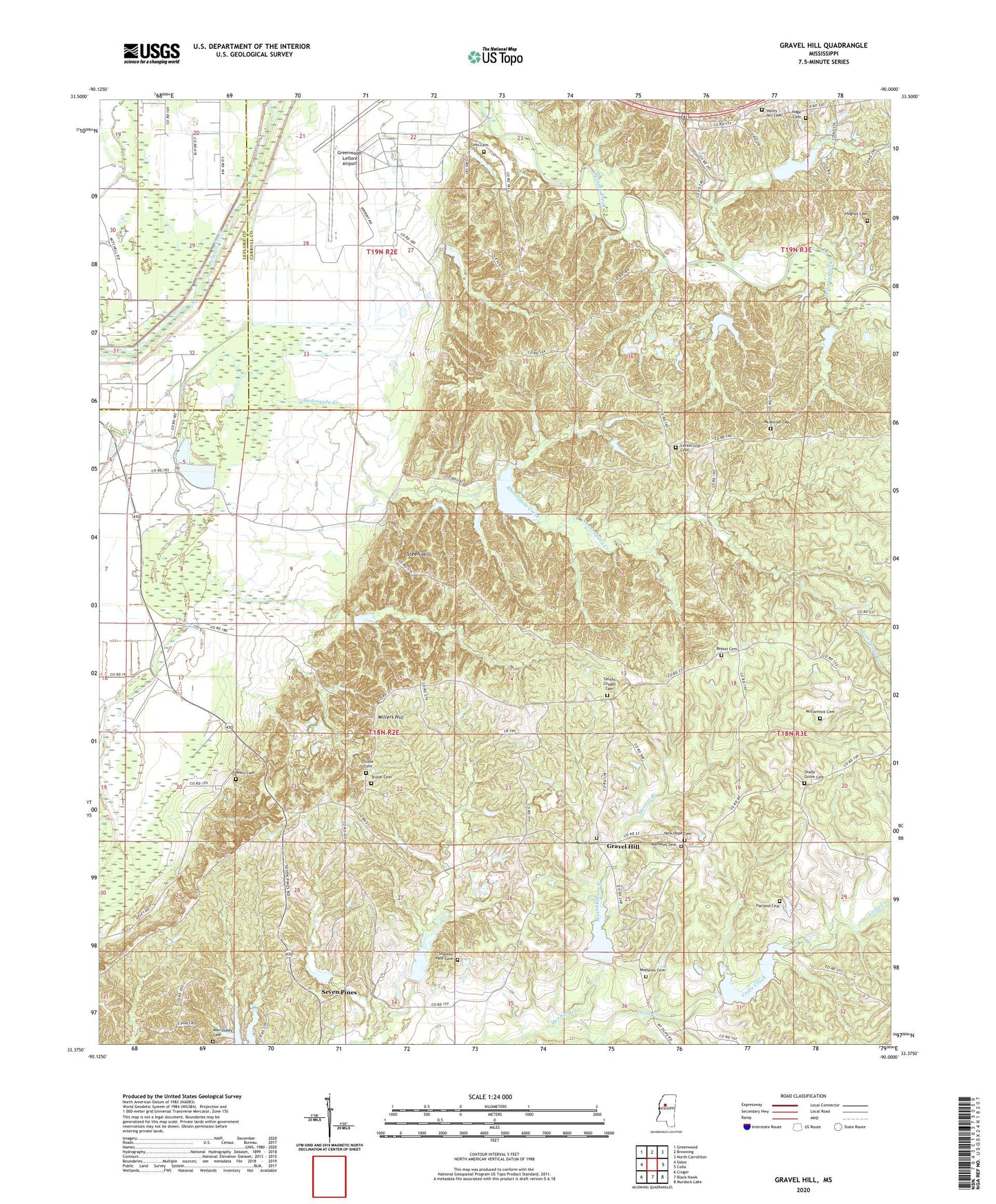
2020 topographic map quadrangle Gravel Hill in the state of Mississippi. Scale: 1:24000. Based on the newly updated USGS 7.5' US Topo map series, this map is in the following counties: Carroll, Leflore. The map contains contour data, water features, and other items you are used to seeing on USGS maps, but also has updated roads and other features. This is the next generation of topographic maps. Printed on high-quality waterproof paper with UV fade-resistant inks.
Quads adjacent to this one:
West: Sidon
Northwest: Greenwood
North: Browning
Northeast: North Carrollton
East: Coila
Southeast: Murdock Lake
South: Black Hawk
Southwest: Cruger
Contains the following named places: Abiaca Watershed Y-34-11 Dam, Abiaca Watershed Y-34-12 Dam, Abiaca Watershed Y-34-13 Dam, Abiaca Watershed Y-34-14 Dam, Abiaca Watershed Y-34-15 Dam, Abiaca Watershed Y-34-16 Dam, Abiaca Watershed Y-34-3 Dam, Abiaca Watershed Y-34-4 Dam, Abiaca Watershed Y-34-6 Dam, Abotcaputa Creek, Bethel Cemetery, Bethel Church, Centerville, Centerville Baptist Church, Centerville Cemetery, Dry Creek, Goss Cemetery, Gravel Hill, Greenwood Army Air Field, Greenwood-Leflore Airport, Harland Cemetery, Hemingway, Hoge Cemetery, Hughes Cemetery, Macrossley Cemetery, Mathews Cemetery, McCormick Cemetery, McMillian Cemetery, Merrill Branch, Merrill Cemetery, Millers Hill, Mount Araint Church, New Hope Cemetery, New Hope Church, New Shiloh Baptist Cemetery, Pelucia Creek Structure Y-33A-20 Dam, Pelucia Creek Structure Y-33A-23 Dam, Pelucia Creek Watershed Y-33A-22 Dam, Rose Hill Cemetery, Shady Grove, Shady Grove Cemetery, Shady Grove Church, Sharkey Pate Cemetery, Shiloh Baptist Church, Smiths Chapel Cemetery, Steen Hill, Stone Cemetery, Valley Hill Church, Valley Hill United Methodist Church Cemetery, Walls Cemetery