MyTopo
Holly Bluff Mississippi US Topo Map
Couldn't load pickup availability
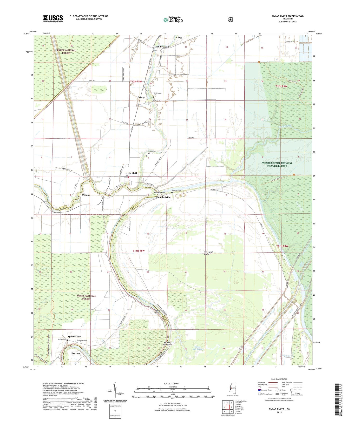
2021 topographic map quadrangle Holly Bluff in the state of Mississippi. Scale: 1:24000. Based on the newly updated USGS 7.5' US Topo map series, this map is in the following counties: Yazoo, Sharkey. The map contains contour data, water features, and other items you are used to seeing on USGS maps, but also has updated roads and other features. This is the next generation of topographic maps. Printed on high-quality waterproof paper with UV fade-resistant inks.
Quads adjacent to this one:
West: Red Rock
Northwest: Rolling Fork East
North: Bayland
Northeast: Louise
East: Bayland SE
Southeast: Satartia
South: Lucre
Southwest: Valley Park
Contains the following named places: Bonny Lodge, Campbellsville Cemetery, Campbellsville Chapel, Campbellville, Crippen Point, Fifteen Mile Bayou, Fifteen Mile Island, Fish Lake, Future Home Lodge, George, Holly Bluff, Holly Bluff Fire Department, Holly Bluff Line Attendance Center, Holly Bluff Post Office, Jeffery Cemetery, Kearney, Kettleman Cemetery, Loch Lomond, Mabin Island, Mabin Lodge, Millers Chapel, New Zion Church, Oak Grove Church, Pan Handle Brake, Panther Creek, Panther Valley Plantation, Patmos, Poor Joe Larkin, Roanoke Lodge, Shannon Cemetery, Silver Creek, Spanish Fort, Tanglewood Cemetery, Tanglewood Plantation, ZIP Code: 39088