MyTopo
Holly Springs SE Mississippi US Topo Map
Couldn't load pickup availability
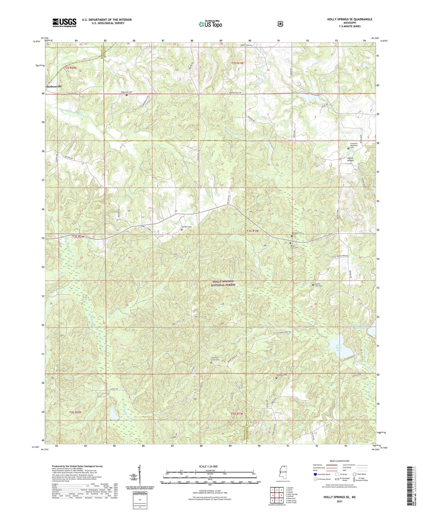
2021 topographic map quadrangle Holly Springs SE in the state of Mississippi. Scale: 1:24000. Based on the newly updated USGS 7.5' US Topo map series, this map is in the following counties: Marshall, Benton. The map contains contour data, water features, and other items you are used to seeing on USGS maps, but also has updated roads and other features. This is the next generation of topographic maps. Printed on high-quality waterproof paper with UV fade-resistant inks.
Quads adjacent to this one:
West: Holly Springs
Northwest: Slayden
North: Lamar
Northeast: Canaan
East: Ashland
Southeast: Chilli Creek
South: Potts Camp
Southwest: Waterford
Contains the following named places: Big Snow Creek, Chestnut Grove Cemetery, Chewalla Lake, Colbert, Free Branch Church, Goodmans Mill, Governor Matthews Cemetery, Grays Creek Watershed Structure Number 11 Dam, Grays Creek Watershed Structure Number 9 Dam, Gresham Lake Dam, Harris Chapel, Hopewell Cemetery, Hopewell Church, Little Snow Creek, Little Snow Lake, LT 7-1 Chewalla Dam, LT 7-2 Dam, LT 7-4 Dam, LT 7-4 Reservoir, Mitchell Cemetery, Mount Zion Cemetery, Mount Zion Church, Nichol Airpark, Powell Chapel, Royston Chapel, Shawnee, Shawnee Cemetery, Snow Creek, Thompson Lake Dam, Tippah River Watershed LT 7-3 Dam