MyTopo
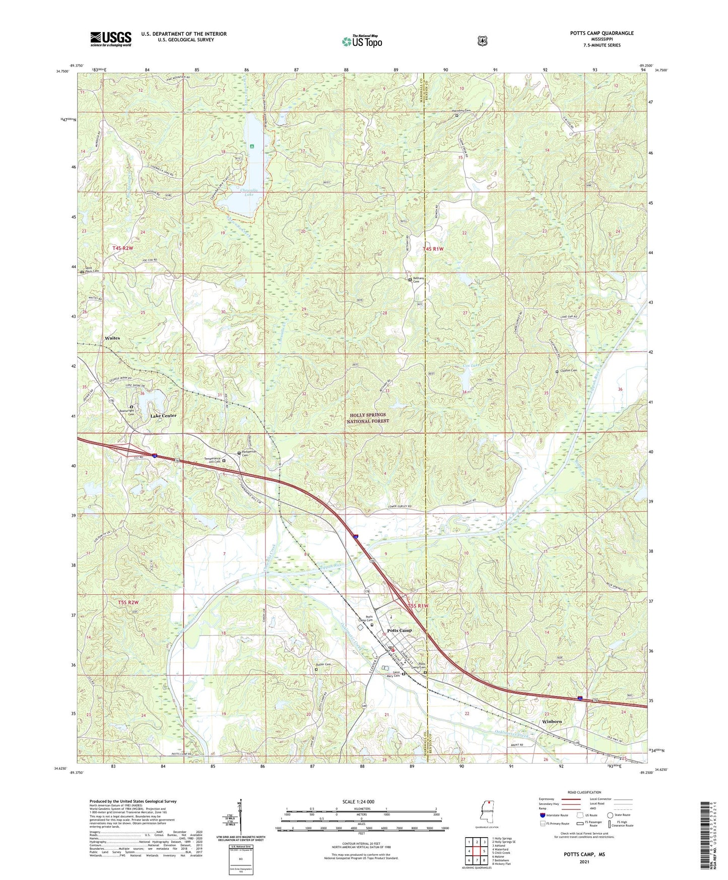
Potts Camp Mississippi US Topo Map
Couldn't load pickup availability
Also explore the Potts Camp Forest Service Topo of this same quad for updated USFS data
2024 topographic map quadrangle Potts Camp in the state of Mississippi. Scale: 1:24000. Based on the newly updated USGS 7.5' US Topo map series, this map is in the following counties: Marshall, Benton. The map contains contour data, water features, and other items you are used to seeing on USGS maps, but also has updated roads and other features. This is the next generation of topographic maps. Printed on high-quality waterproof paper with UV fade-resistant inks.
Quads adjacent to this one:
West: Waterford
Northwest: Holly Springs
North: Holly Springs SE
Northeast: Ashland
East: Chilli Creek
Southeast: Hickory Flat
South: Bethlehem
Southwest: Malone
This map covers the same area as the classic USGS quad with code o34089f3.
Contains the following named places: Airs School, Bethany Cemetery, Bethany Church, Beulah Hill Church, Boatwright Cemetery, Bond Lake Dam, Brady Branch, Butler Cemetery, Chewalla Church, Chewalla Creek, Chewalla Lake, Chewalla Organization Camp, Chewalla Recreation Area, Clayton Cemetery, Cox Lake, Dickey Lake Dam, Drivers School, First Baptist Church, Harmony Cemetery, Hudspeth Lake Dam, Lake Center, Lake Center Dam, Lonoke, Lonoke Church, LT 7-10 Dam, LT 7-10 Lake, Mary Reid School, Moody, New Hope School, Nichols Lake Dam, Oaklimeter Creek, Oaklimeter Watershed LT-8-35 Dam, Open Door Baptist Church, Pemberton Cemetery, Pine Mountain Overlook, Potts Camp, Potts Camp Cemetery, Potts Camp Post Office, Potts Camp School, Potts Camp Volunteer Fire Department, Potts Camp Work Center, Reeds Gift Church, Saint Mary Cemetery, Saint Mary Church, Saint Pauls Cemetery, Saint Pauls Church, Tacaleechi, Temperance Hill Cemetery, Temperance Hill Church, Thompson Lake Dam, Tippah River Watershed LT-7-1 Dam, Town of Potts Camp, White Lake Dam, Winborn