MyTopo
Waterford Mississippi US Topo Map
Couldn't load pickup availability
Also explore the Waterford Forest Service Topo of this same quad for updated USFS data
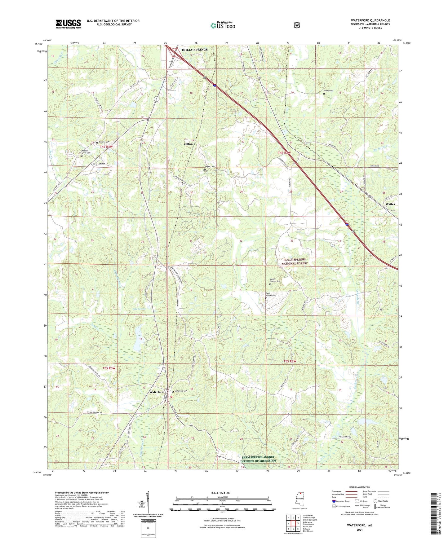
2024 topographic map quadrangle Waterford in the state of Mississippi. Scale: 1:24000. Based on the newly updated USGS 7.5' US Topo map series, this map is in the following counties: Marshall. The map contains contour data, water features, and other items you are used to seeing on USGS maps, but also has updated roads and other features. This is the next generation of topographic maps. Printed on high-quality waterproof paper with UV fade-resistant inks.
Quads adjacent to this one:
West: Marianna
Northwest: Red Banks
North: Holly Springs
Northeast: Holly Springs SE
East: Potts Camp
Southeast: Bethlehem
South: Malone
Southwest: Laws Hill
This map covers the same area as the classic USGS quad with code o34089f4.
Contains the following named places: Beverly Cemetery, Beverly Chapel, Beverly Chapel School, Bill Chapman Dam, Bonds Realty Company Lake Dam, Calame Lake Dam, Calvin Chapel, Calvin Chapel School, Dean Lake Dam, Finley Cemetery, Gilton, Goldsmith Lake, Holly Hill Church, Jeffries Lake Dam, Jones Grove Baptist Church, Lake Daroma, McKenney School, Mississippi No Name 186 Dam, Mississippi No Name 199 Dam, Moore Lake Dam, Mount Teamor Cemetery, Mount Teamor Church, Murdock Lake Dam, Oak Grove Church, Pegues Cemetery, Pegues School, Pleasant Grove Cemetery, Saint Mark Church, Sand Creek, Sauls Chapel Cemetery, Smith Lake Dam, Souls Chapel, Spring Lake, Supervisor District 5, Waites, Walker Lake Dam, Wall Doxey State Park, Wall Doxey State Park Lake Dam, Waltons Chapel, Waterford, Waterford Cemetery, Waterford Census Designated Place, Waterford Post Office, Waterford Volunteer Fire Department