MyTopo
Indianola Mississippi US Topo Map
Couldn't load pickup availability
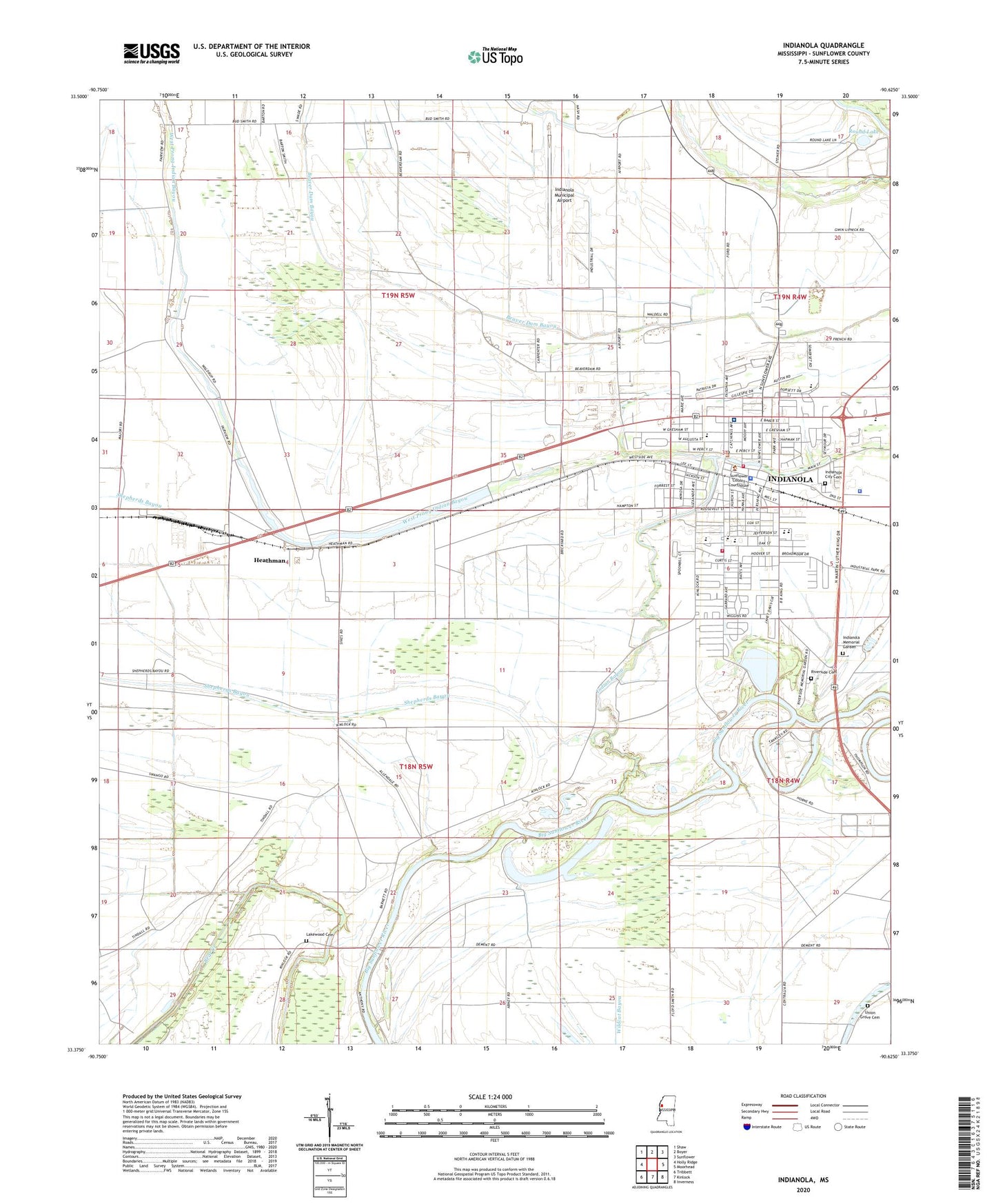
2020 topographic map quadrangle Indianola in the state of Mississippi. Scale: 1:24000. Based on the newly updated USGS 7.5' US Topo map series, this map is in the following counties: Sunflower. The map contains contour data, water features, and other items you are used to seeing on USGS maps, but also has updated roads and other features. This is the next generation of topographic maps. Printed on high-quality waterproof paper with UV fade-resistant inks.
Quads adjacent to this one:
West: Holly Ridge
Northwest: Shaw
North: Boyer
Northeast: Sunflower
East: Moorhead
Southeast: Inverness
South: Kinlock
Southwest: Tribbett
Contains the following named places: Assembly of God Church, Bay Lake, Bay Lake School, Beasley Lake, Bell Grove Baptist Church, Bethlehem Church Number 1, Bethlehem Church Number 2, Bethlehem School, Billups Plantation Airport, Bryants African Methodist Episcopal Church, Carver Elementary School, Carver Middle School, Carver School, Church of Christ, Church of the Immaculate Conception, City of Indianola, East Prong Indian Bayou, First Baptist Church, First Presbyterian Church, First United Methodist Church, Fratesi Pond Dam, Friendship Church, Gentry High School, Heard Ferry, Heards Landing, Heathman, Heathman School, Indian Bayou, Indian Bayou Church, Indianola, Indianola Academy, Indianola Baptist Church, Indianola City Cemetery, Indianola City Hall, Indianola Country Club, Indianola Fire Department Station 1, Indianola Fire Department Station 2, Indianola High School, Indianola Junior High School, Indianola Memorial Garden, Indianola Municipal Airport, Indianola Police Department, Indianola Post Office, Indianola Sewage Lagoon Dam, Indianola Shopping Center, Kings Daughters Hospital, Lakewood Cemetery, Legion Field, Lockard Elementary School, Mount Beulah Baptist Church, Mount Moriah Church, Mount Moriah School, Mount Zion Church, Pilgrim Rest Church, Pleasant Green Church, Raspberry Memorial Methodist Episcopal Church, Riverside Cemetery, Round Lake, Saint Mathews Church, Saint Stephens Episcopal Church, Saints Rest Church, Saints Rest Plantation, Second Baptist Church, Seymour Library, Shepherds Bayou, Short Bayou, South Sunflower County Hospital, Sunflower County Courthouse, Sunflower County Health Center, Sunflower County Jail, Sunflower County Sheriff's Office, Supervisor District 2, Thigpen Lake, Union Grove Cemetery, Union Grove Church, Union Star Church, West Prong Indian Bayou, WNLA-AM (Indianola), WNLA-FM (Indianola), ZIP Code: 38751