MyTopo
Kinlock Mississippi US Topo Map
Couldn't load pickup availability
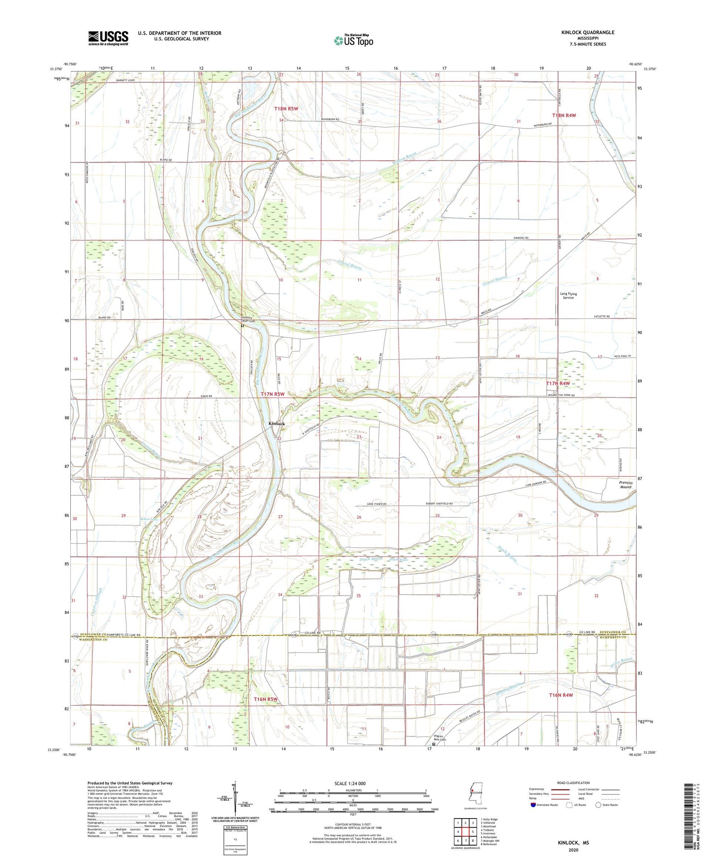
2024 topographic map quadrangle Kinlock in the state of Mississippi. Scale: 1:24000. Based on the newly updated USGS 7.5' US Topo map series, this map is in the following counties: Sunflower, Humphreys, Washington. The map contains contour data, water features, and other items you are used to seeing on USGS maps, but also has updated roads and other features. This is the next generation of topographic maps. Printed on high-quality waterproof paper with UV fade-resistant inks.
Quads adjacent to this one:
West: Tribbett
Northwest: Holly Ridge
North: Indianola
Northeast: Moorhead
East: Inverness
Southeast: Bellewood
South: Midnight NW
Southwest: Hollandale
This map covers the same area as the classic USGS quad with code o33090c6.
Contains the following named places: Alice School, Bay Lake Run, Bear Creek, Big Morning Star Church, Bogue Phalia, Brady Landing, Clear Lake, Craig Plantation, Cypress Slough, Dabney Brake, Davis Landing, Dawson Bayou, Ditch Number Thirtyfour, Ditch Number Twentyseven, Dutch Bayou, Dutch Brake, Elmwood Plantation, Floyd, Gravel Bayou, Gumwood Plantation, Hickory Bluff Cemetery, Hickory Bluff Landing, Hollywood Landing, Kinlock, Kinlock School, Lake Dawson, Lang Flying Service, Little Morning Star Church, Locust Bayou, Martin Lake, Melton Lake, New Berlin Landing, New Bethley Church, Pilgrim Green Church, Pilgrim Rest Cemetery, Pilgrim Rest Church, Prentiss Mound, Price School, Rising Star Church, Saint Johns Church, Shell Ridge Landing, Sory and Towery Lake Dam, Strangers Home Church, Sycamore Plantation, Union Grove Elementary School, Waco Church, Waco Plantation, Wildcat Bayou, Woodburn Plantation, Woodburn School, Zion Field Church