MyTopo
Lodi Mississippi US Topo Map
Couldn't load pickup availability
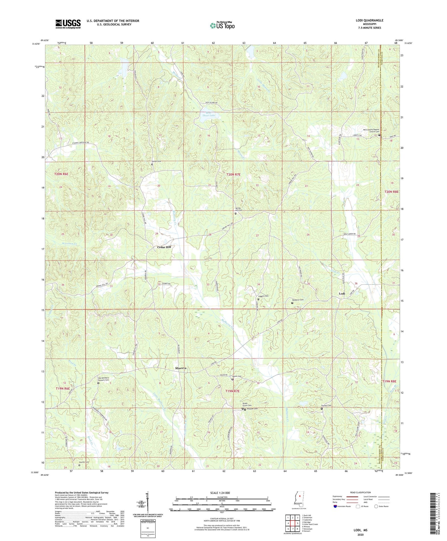
2020 topographic map quadrangle Lodi in the state of Mississippi. Scale: 1:24000. Based on the newly updated USGS 7.5' US Topo map series, this map is in the following counties: Montgomery, Webster. The map contains contour data, water features, and other items you are used to seeing on USGS maps, but also has updated roads and other features. This is the next generation of topographic maps. Printed on high-quality waterproof paper with UV fade-resistant inks.
Quads adjacent to this one:
West: Eskridge
Northwest: Duck Hill
North: Sweatman
Northeast: Cadaretta
East: Little Sand Creek
Southeast: Stewart
South: Kilmichael
Southwest: Winona
Contains the following named places: Beat Three Lake, Bogue Watershed Y-30-52 Dam, Bogue Watershed Y-30-89 Dam, Bogue Watershed Y-54-38 Dam, Bronte Cemetery, Campbells Branch, Cedar Hill, Choctawville, Church of the Living God, Dabney, Edwards School, Laura, Lodi, Lodi Creek, Loggins Cemetery, Minerva, Mulberry Baptist Church, Mulberry Cemetery, New Liberty Baptist Church, New Liberty Baptist Church Cemetery, Old Northern Grocery Cemetery, Patts Branch, Pittman Cemetery, Pleasant Hill Church, Purnell Cemetery, Salem Cemetery, Salem Church, Shady Grove Cemetery, Shady Grove Church, Shiloh Baptist Church, Shiloh Cemetery, Spring Hill Cemetery, Spring Hill Church, Spring Hill School, Sugar Hill, Supervisor District 3, Union Grove Missionary Baptist Church, Young School, Youngs Chapel