MyTopo
Winona Mississippi US Topo Map
Couldn't load pickup availability
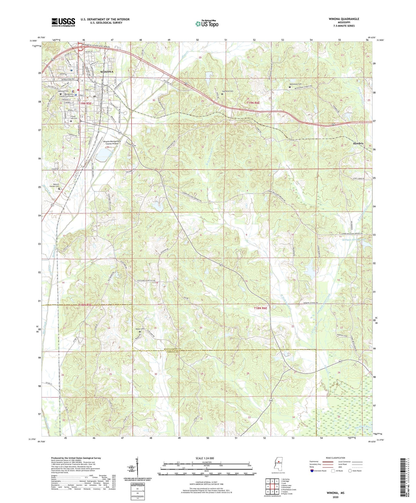
2024 topographic map quadrangle Winona in the state of Mississippi. Scale: 1:24000. Based on the newly updated USGS 7.5' US Topo map series, this map is in the following counties: Montgomery, Carroll. The map contains contour data, water features, and other items you are used to seeing on USGS maps, but also has updated roads and other features. This is the next generation of topographic maps. Printed on high-quality waterproof paper with UV fade-resistant inks.
Quads adjacent to this one:
West: Bailey Lake
Northwest: McCarley
North: Eskridge
Northeast: Lodi
East: Kilmichael
Southeast: Poplar Creek
South: Vaiden
Southwest: Peachahala Creek
This map covers the same area as the classic USGS quad with code o33089d6.
Contains the following named places: Bethlehem Cemetery, Bethlehem Church, Biblical Garden Cemetery, Campbell Hill Church, Caney Creek, Carroll, City of Winona, Columbiana Church, East Fork Lewis Creek, Elliott, Elmer Pruitt Pond Dam, First Baptist Church, First Presbyterian Church, Foltz, Forest Hill Cemetery, Gum Branch, Harmony Church, Haven United Methodist Church, Hendrix, J H Collins Lake Dam, Kingdom Hall of Jehovahs Witnesses, Knox High School, Mason Cemetery, Milligan Springs Lake, Montgomery County Courthouse, Montgomery County Sheriff's Office, Moore Memorial United Methodist Church, Mount Vernon Church, Murrell Branch, North Winona Baptist Church, Oakwood Cemetery, Rodney Mortimer Lake Dam, Scotland Church, Townsend Cemetery, Tyler Holmes Memorial Hospital, West Fork Lewis Creek, Winona, Winona Baptist Church, Winona Country Club, Winona Country Club Dam, Winona Fire Department, Winona High School, Winona Junior High School, Winona Police Department, Winona Post Office, Winona Sewage Lagoon Dam, Winona-Montgomery County Airport, WONA-AM (Winona), WONA-FM (Winona), Wood, ZIP Code: 38967