MyTopo
Mount Pleasant Mississippi US Topo Map
Couldn't load pickup availability
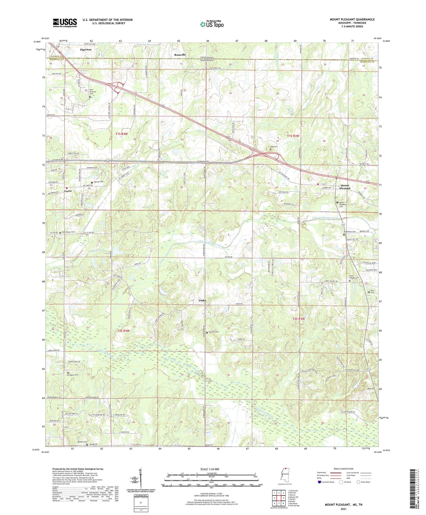
2021 topographic map quadrangle Mount Pleasant in the state of Mississippi. Scale: 1:24000. Based on the newly updated USGS 7.5' US Topo map series, this map is in the following counties: Marshall, Fayette. The map contains contour data, water features, and other items you are used to seeing on USGS maps, but also has updated roads and other features. This is the next generation of topographic maps. Printed on high-quality waterproof paper with UV fade-resistant inks.
Quads adjacent to this one:
West: Byhalia NW
Northwest: Collierville
North: Rossville
Northeast: Moscow
East: Slayden
Southeast: Holly Springs
South: Red Banks
Southwest: Byhalia
Contains the following named places: Bainsville School, Bennie School, Benton Cemetery, Brittenum Cemetery, Carey Chapel, Carey Chapel Cemetery, Carington Cemetery, Cayce, Cayce Marshall County Volunteer Fire Department, Chickasaw School, Cooperwood School, Edrizon Cemetery, Hilbert School, Kilpatrick School, King Cemetery, Little Coldwater Creek, Luck, Marshall Institute Church, Mount Newell Missionary Baptist Church, Mount Pleasant, Mount Pleasant Cemetery, Mount Pleasant Census Designated Place, Mount Pleasant Church, Mount Pleasant Post Office, Mount Zion Church, New Salem Cemetery, New Salem Church, New Shannon Cemetery, New Shannon School, New Sharron Church, Newest Cemetery, Newest Church, Olive Cemetery, Opossum Creek, Pleasant Hill Church, Ragford School, Royal Chapel, Slayden - Mount Pleasant Volunteer Fire Department, Taska, Union Church, ZIP Code: 38661