MyTopo
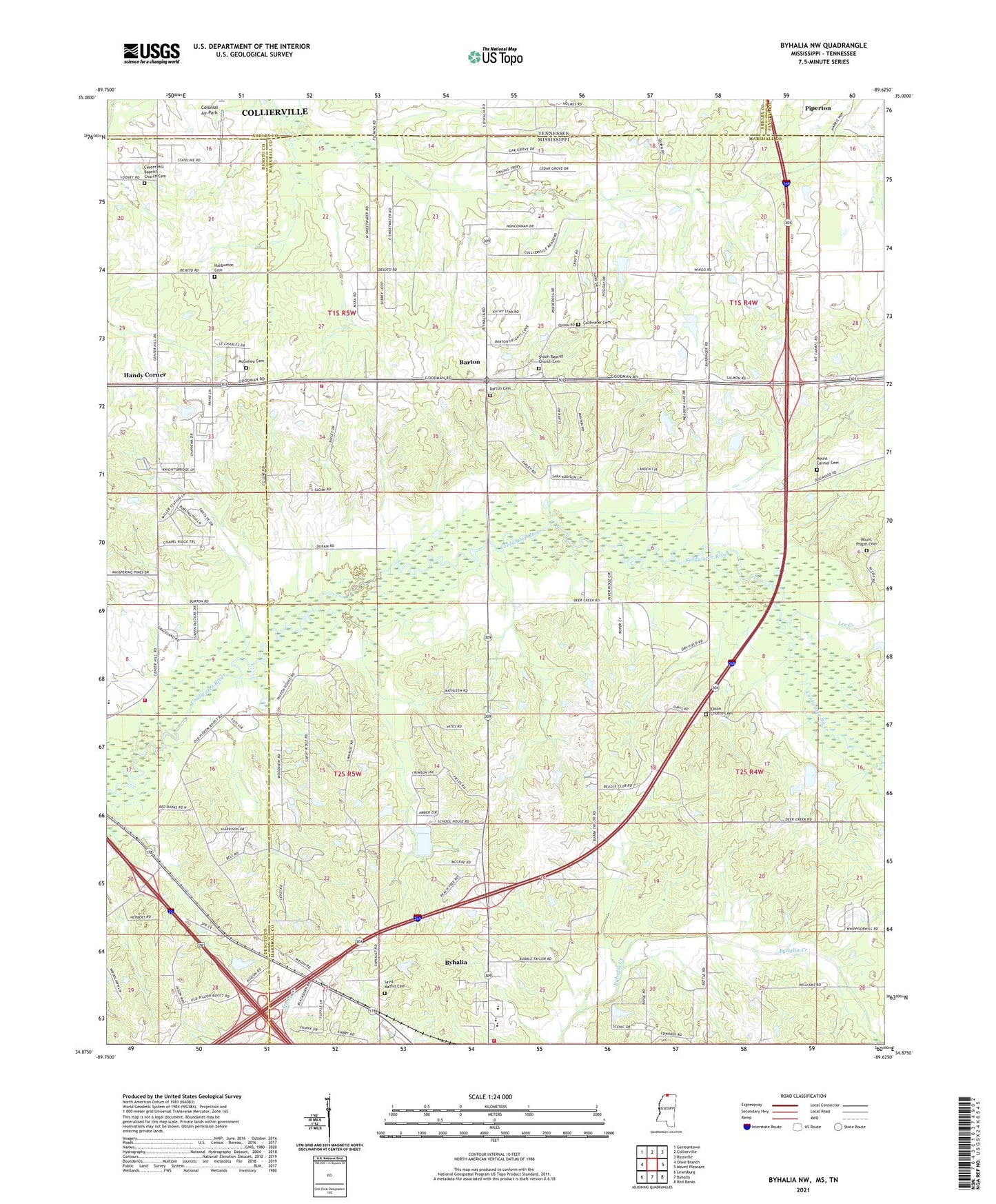
Byhalia NW Mississippi US Topo Map
Couldn't load pickup availability
2024 topographic map quadrangle Byhalia NW in the states of Mississippi, Tennessee. Scale: 1:24000. Based on the newly updated USGS 7.5' US Topo map series, this map is in the following counties: Marshall, DeSoto, Shelby, Fayette. The map contains contour data, water features, and other items you are used to seeing on USGS maps, but also has updated roads and other features. This is the next generation of topographic maps. Printed on high-quality waterproof paper with UV fade-resistant inks.
Quads adjacent to this one:
West: Olive Branch
Northwest: Germantown
North: Collierville
Northeast: Rossville
East: Mount Pleasant
Southeast: Red Banks
South: Byhalia
Southwest: Lewisburg
Contains the following named places: Barton, Barton Cemetery, Barton Church, Barton Volunteer Fire Department, Byhalia School, Byhalia Volunteer Fire Department Station 2, Center Hill Baptist Church, Center Hill Baptist Church Cemetery, Centre Hill, Church of Christ, Coldwater Cemetery, Coldwater Church, Colonial Air Park, Eason Church, Eason Church Cemetery, Eason School, Fair Haven Volunteer Fire Department, Haliburton Cemetery, Halliburton Church, Halliburton School, Handy Corner, Hearn Grove Church, Hearn Grove School, Hopeville, Irons School, Lee Creek, McGehee Cemetery, Meadow Brook Baptist Church, Mount Carmel Associate Reformed Presbyterian Church, Mount Carmel Cemetery, Mount Pisgah Cemetery, New Hardy Church, Reynolds Box, Saint Mathis Cemetery, Saint Matthew Church, Shiloh Baptist Church, Shiloh Baptist Church Cemetery, Supervisor District 3, WMSO-AM (Collierville)