MyTopo
New Augusta Mississippi US Topo Map
Couldn't load pickup availability
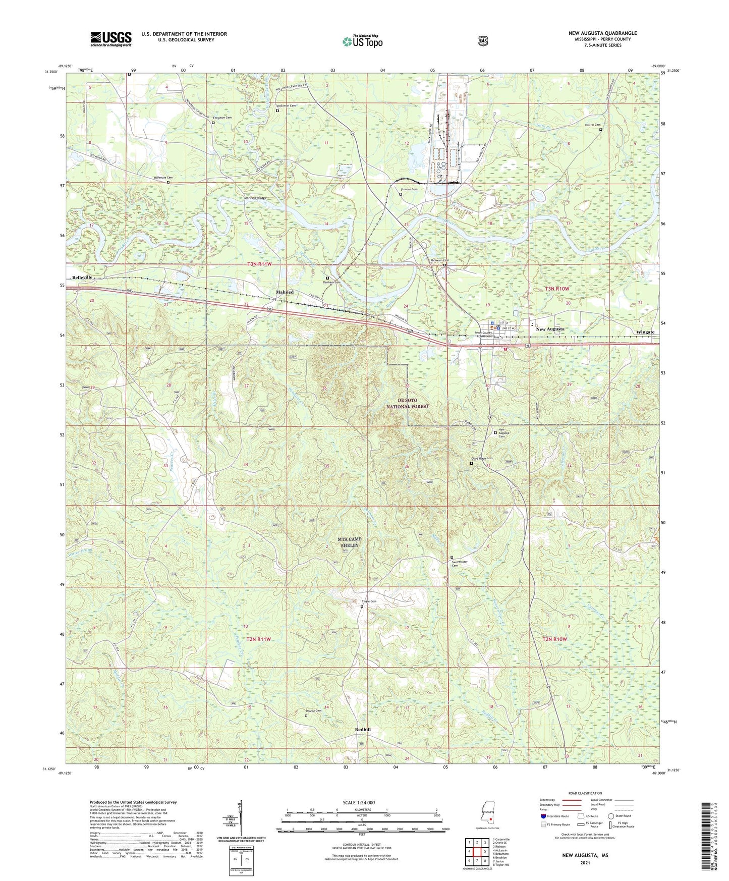
2021 topographic map quadrangle New Augusta in the state of Mississippi. Scale: 1:24000. Based on the newly updated USGS 7.5' US Topo map series, this map is in the following counties: Perry. The map contains contour data, water features, and other items you are used to seeing on USGS maps, but also has updated roads and other features. This is the next generation of topographic maps. Printed on high-quality waterproof paper with UV fade-resistant inks.
Quads adjacent to this one:
West: McLaurin
Northwest: Carterville
North: Ovett SE
Northeast: Richton
East: Beaumont
Southeast: Taylor Hill
South: Janice
Southwest: Brooklyn
Contains the following named places: Biloxi Regional Sewer Treatment Plant West, Burleman Branch, Davis KD Range, Denham Cemetery, Denham Creek, Ferguson Cemetery, Goodhope Baptist Church, Gum Branch, Hinton Cemetery, Hollimon Cemetery, Mahned, Mahned Bridge, Mahned Church, McKenzie Cemetery, McSwain Cemetery, Miles Branch, Milky Creek, New Augusta, New Augusta Cemetery, New Augusta Elementary School, New Augusta Fire Department, New Augusta Police Department, New Augusta Post Office, New Augusta Volunteer Fire Department, Nichols Cemetery, Old Augusta, Old Augusta Boat Ramp, Perry Central High School, Perry County Sheriff's Office, Red Hill School, Redhill, Redhill Branch, Stevens Cemetery, Supervisor District 1, Sweetwater, Sweetwater Cemetery, Sweetwater Church, Tallahala Creek, Town of New Augusta, Water Prong, Water Valley Sewage Lagoon, Wingate, ZIP Code: 39462