MyTopo
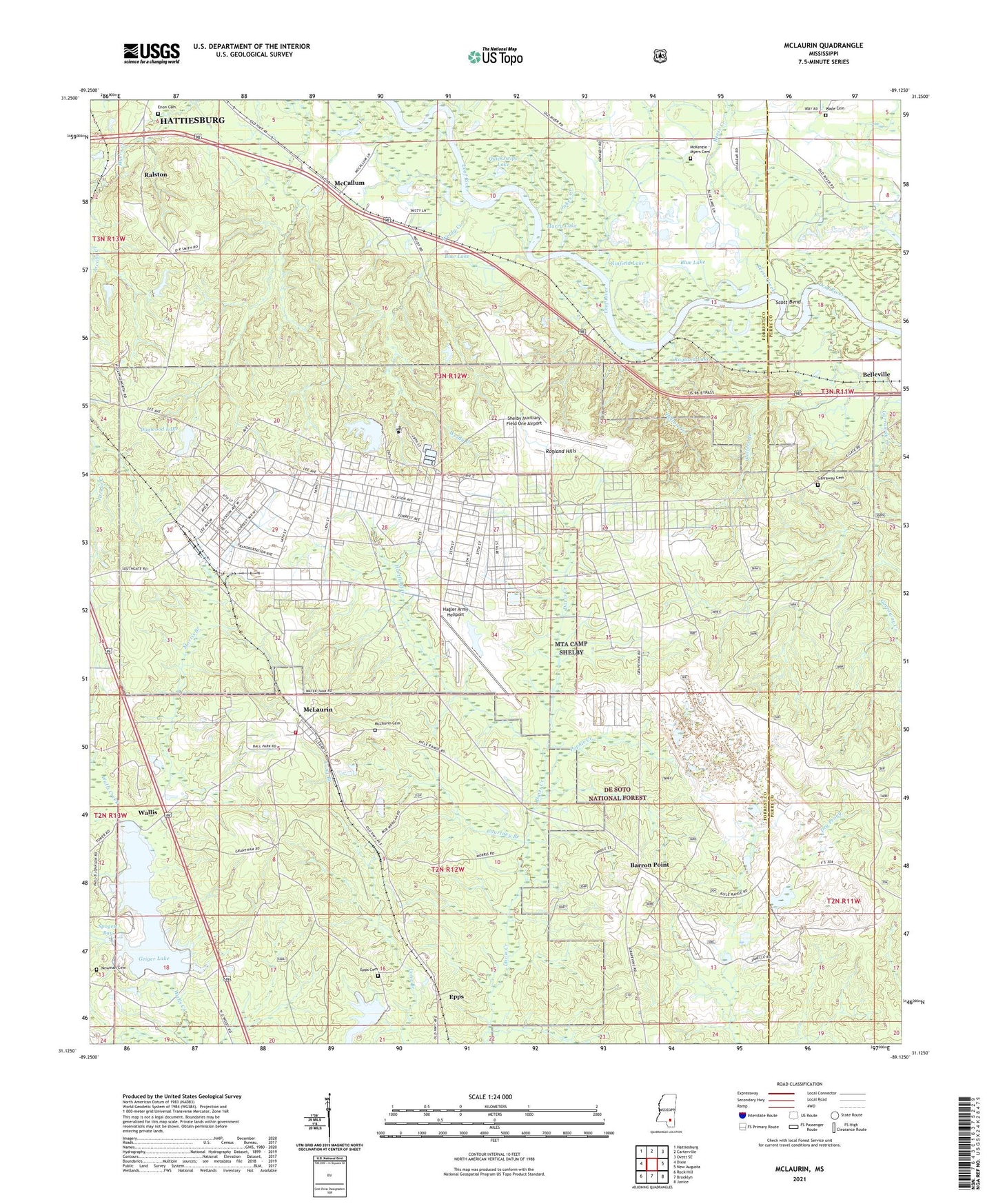
McLaurin Mississippi US Topo Map
Couldn't load pickup availability
Also explore the McLaurin Forest Service Topo of this same quad for updated USFS data
2024 topographic map quadrangle McLaurin in the state of Mississippi. Scale: 1:24000. Based on the newly updated USGS 7.5' US Topo map series, this map is in the following counties: Forrest, Perry. The map contains contour data, water features, and other items you are used to seeing on USGS maps, but also has updated roads and other features. This is the next generation of topographic maps. Printed on high-quality waterproof paper with UV fade-resistant inks.
Quads adjacent to this one:
West: Dixie
Northwest: Hattiesburg
North: Carterville
Northeast: Ovett SE
East: New Augusta
Southeast: Janice
South: Brooklyn
Southwest: Rock Hill
This map covers the same area as the classic USGS quad with code o31089b2.
Contains the following named places: Barron Point, Belleville, Bethesda Home for Girls, Blue Lake, Braiden Creek, Buckeye Trail, Camp Shelby, Camp Shelby Joint Forces Training Center Fire Department, Camp Shelby Lake Dam, Courtney Branch, Dogwood Lake, Dogwood Lake Dam, Dry Prong, Enon Cemetery, Epps, Epps Cemetery, Garraway Cemetery, Garraway Creek, Geiger Lake, Ginfield Lake, Glenn D Walker Lake, Greenwood Water Treatment Plant, Hagler Army Airport, Harry Lake, Hartfield Creek, Helton Creek, Jakes Creek, Joe Morgan Lake Dam, Lake Shelby Dam, Lone Pine Fire Tower, Lower Dead River, Maneuver Training Area Camp Shelby, McCallum, McKenzie - Myers Cemetery, McLaurin, McLaurin Cemetery, McLaurin Landing Field, McLaurin Recreation Center, McLaurin United Methodist Church, McLaurin Volunteer Fire Department Station 1, Morning Star Church, Morris Branch, Newman Cemetery, Old Enon Church, Paul B Johnson State Park, Quickswipe Lake, Ragland, Ragland Hills, Ragland Lake, Ralston, Reese Creek, Scott Bend, Shelby Auxiliary Field One Airport, Spogett Bay, Sportsman Club Lake Dam, Sportsman Lake, Supervisor District 4, Sweet Pilgrim Church, Upper Dead River, Wade Cemetery, Wallis, Walters Branch, Weldy Creek