MyTopo
Oakland Mississippi US Topo Map
Couldn't load pickup availability
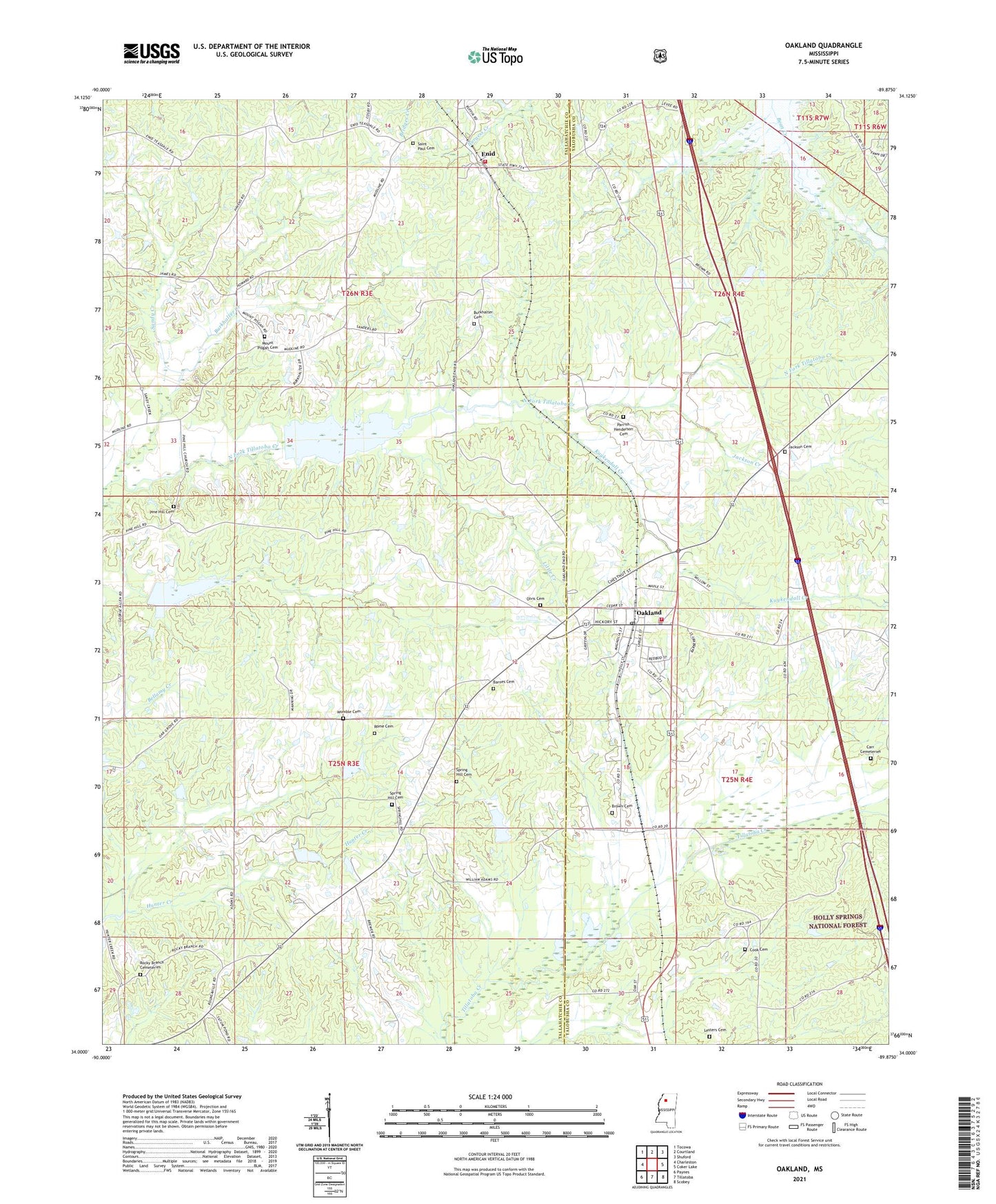
2021 topographic map quadrangle Oakland in the state of Mississippi. Scale: 1:24000. Based on the newly updated USGS 7.5' US Topo map series, this map is in the following counties: Tallahatchie, Yalobusha. The map contains contour data, water features, and other items you are used to seeing on USGS maps, but also has updated roads and other features. This is the next generation of topographic maps. Printed on high-quality waterproof paper with UV fade-resistant inks.
Quads adjacent to this one:
West: Charleston
Northwest: Tocowa
North: Courtland
Northeast: Shuford
East: Coker Lake
Southeast: Scobey
South: Tillatoba
Southwest: Paynes
Contains the following named places: Barnes Cemetery, Blanche, Brown Cemetery, Burkhalter Cemetery, Burkhalter Creek, Carr Cemeteries, Center Point, Cook Cemetery, Enid, Enid Volunteer Fire Department, House Lake Dam, Indian Church, Jackson Cemetery, Jackson Creek, Kuykendall Creek, Lesters Cemetery, Masgrove Church, Masgrove School, Mount Pisgah Cemetery, Mount Pisgah Church, Oakland, Oakland Elementary School, Oakland High School, Oakland Post Office, Oakland Volunteer Fire Department, Olvis Cemetery, Olvis Grove Church, Paris Grove Church, Parrish Henderson Cemetery, Pine Hill Cemetery, Pine Hill Church, Rocky Branch Cemeteries, Rome Cemetery, Saint Paul Cemetery, Saint Paul Church, Sandy Church, Sandy Creek, Spring Hill Cemetery, Spring Hill Church, Tillatoba Creek Y-17b-17 Dam, Tillatoba Creek Y-17b-7 Dam, Town of Oakland, Union Church, Walnut Grove Church, Womble Cemetery, ZIP Code: 38948