MyTopo
Shuford Mississippi US Topo Map
Couldn't load pickup availability
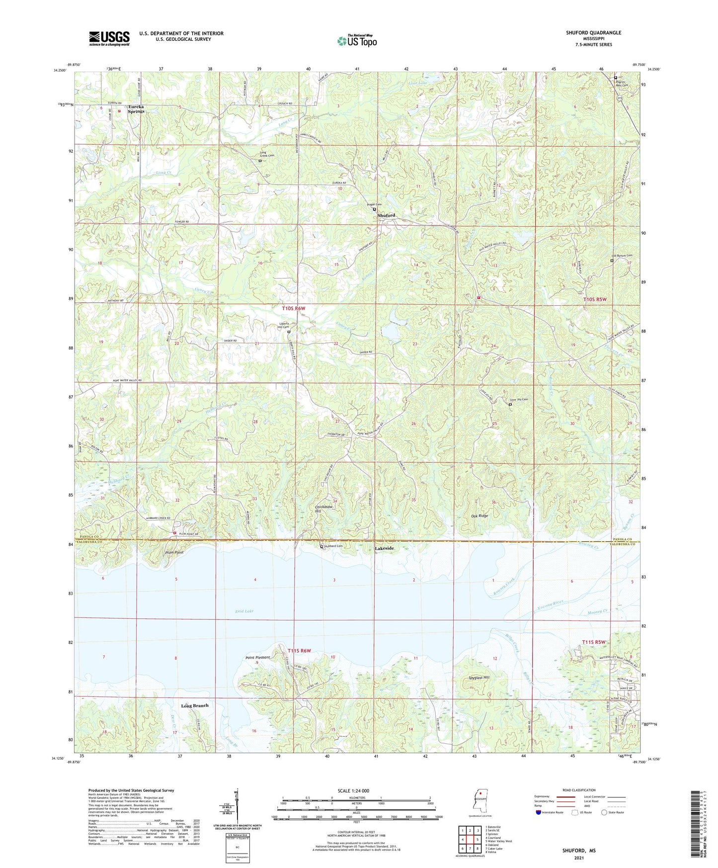
2024 topographic map quadrangle Shuford in the state of Mississippi. Scale: 1:24000. Based on the newly updated USGS 7.5' US Topo map series, this map is in the following counties: Panola, Yalobusha. The map contains contour data, water features, and other items you are used to seeing on USGS maps, but also has updated roads and other features. This is the next generation of topographic maps. Printed on high-quality waterproof paper with UV fade-resistant inks.
Quads adjacent to this one:
West: Courtland
Northwest: Batesville
North: Sardis SE
Northeast: Splinter
East: Water Valley West
Southeast: Velma
South: Coker Lake
Southwest: Oakland
This map covers the same area as the classic USGS quad with code o34089b7.
Contains the following named places: Albert Barnett Pond Dam, Basin Chapel, Billys Creek, Bynum Fire Department District 9 Station 1, Bynum Fire Department District 9 Station 2, Bynum Fire Department District 9 Station 3, Bynums Creek, Chickasaw Hill, Chickasaw Hill Recreation Area, Dew Creek, Elliotts Mills, Enid Lake, Eureka Springs, Eureka Springs Methodist Church, Hubbard Cemetery, Jones Creek, Kenny Creek, Lakeside, Liberty Hill Cemetery, Liberty Hill Church, Lone Lake, Long Branch, Long Branch Recreation Area, Long Creek Cemetery, Long Creek Church, Long Creek Watershed Y-11a-23 Dam, Long Creek Watershed Y-11a-24 Dam, Long Creek Watershed Y-11a-6 Dam, Love Joy Cemetery, Love Joy Church, McGees, Mooney Creek, Oak Ridge, Old Bynum Cemetery, Oliver Ray Church, Oliver Ray School, Pilgrim Rest Cemetery, Pilgrims Rest Church, Pisgah Cemetery, Pisgah Church, Plum Point, Plum Point Recreation Area, Point Pleasant, Point Pleasant Recreation Area, Reynolds, Rowsey Creek, Shuford, Spyglass Hill, Water Valley Landing, Water Valley Landing Recreation Area