MyTopo
Coker Lake Mississippi US Topo Map
Couldn't load pickup availability
Also explore the Coker Lake Forest Service Topo of this same quad for updated USFS data
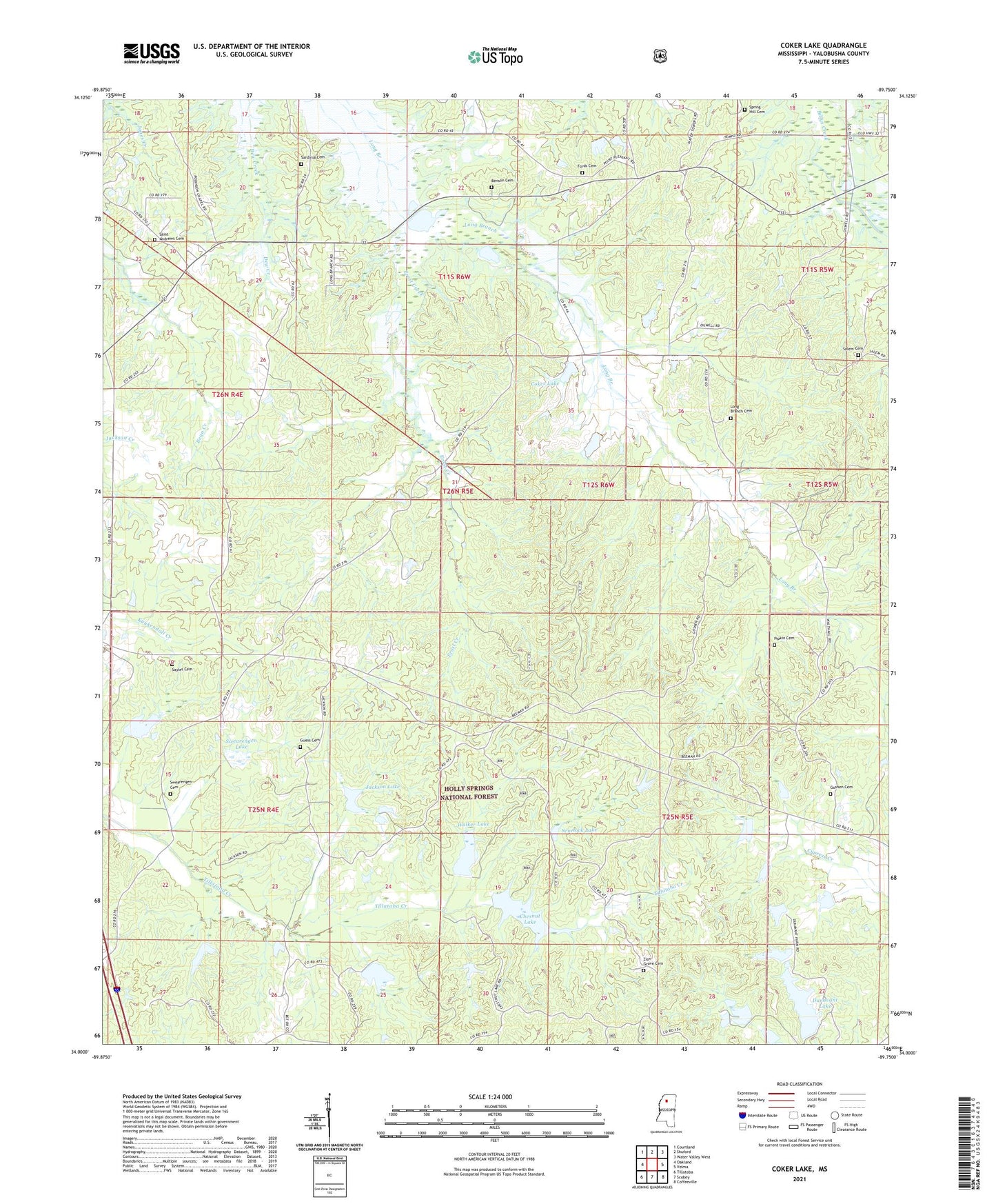
2024 topographic map quadrangle Coker Lake in the state of Mississippi. Scale: 1:24000. Based on the newly updated USGS 7.5' US Topo map series, this map is in the following counties: Yalobusha. The map contains contour data, water features, and other items you are used to seeing on USGS maps, but also has updated roads and other features. This is the next generation of topographic maps. Printed on high-quality waterproof paper with UV fade-resistant inks.
Quads adjacent to this one:
West: Oakland
Northwest: Courtland
North: Shuford
Northeast: Water Valley West
East: Velma
Southeast: Coffeeville
South: Scobey
Southwest: Tillatoba
This map covers the same area as the classic USGS quad with code o34089a7.
Contains the following named places: Benson Cemetery, Buck Hill, Chesnut Lake, Coffeeville Lookout Tower, Coker Lake, Coulter Lake, Cypress Creek Watershed Y-19a-5 Dam, Cypress Creek Watershed Y-19a-6 Dam, Cypress Creek Watershed Y-19a-7 Dam, Cypress Creek Watershed Y-19a-8 Dam, Cypress Creek Watershed Y-19a-9 Dam, Dunavant Lake, Erost Creek, Fords Cemetery, Fords Well, Fords Well Church, Goshen Cemetery, Goshen Church, Guess Cemetery, Hatton, Jackson Lake, Larry Dyer Pond Dam, Leggo, Lick Branch School, Locust Grove Church, Locust Grove School, Long Branch Cemetery, Nebo Store, Philadelphia Church, Pipkin Cemetery, Roberson Chapel, Roberson School, Saint Andrews Cemetery, Saint Andrews Church, Salem Cemetery, Sardinia, Sardinia Cemetery, Sayles Cemetery, Scurlock Lake, Spring Hill Cemetery, Supervisor District 4, Swearengen Cemetery, Swearengen Lake, Sweet Home Church, Tillatoba Creek Watershed Y-17b-8 Dam, Tillatoba Creek Y-17b-9 Dam, Tom Bell Lake Dam, W B Donovan Lake Dam, Walker Lake, Yo-26-11 Dam, Yo-26-8 Dam, Zion Grove Cemetery, Zion Grove Church