MyTopo
Olive Branch Mississippi US Topo Map
Couldn't load pickup availability
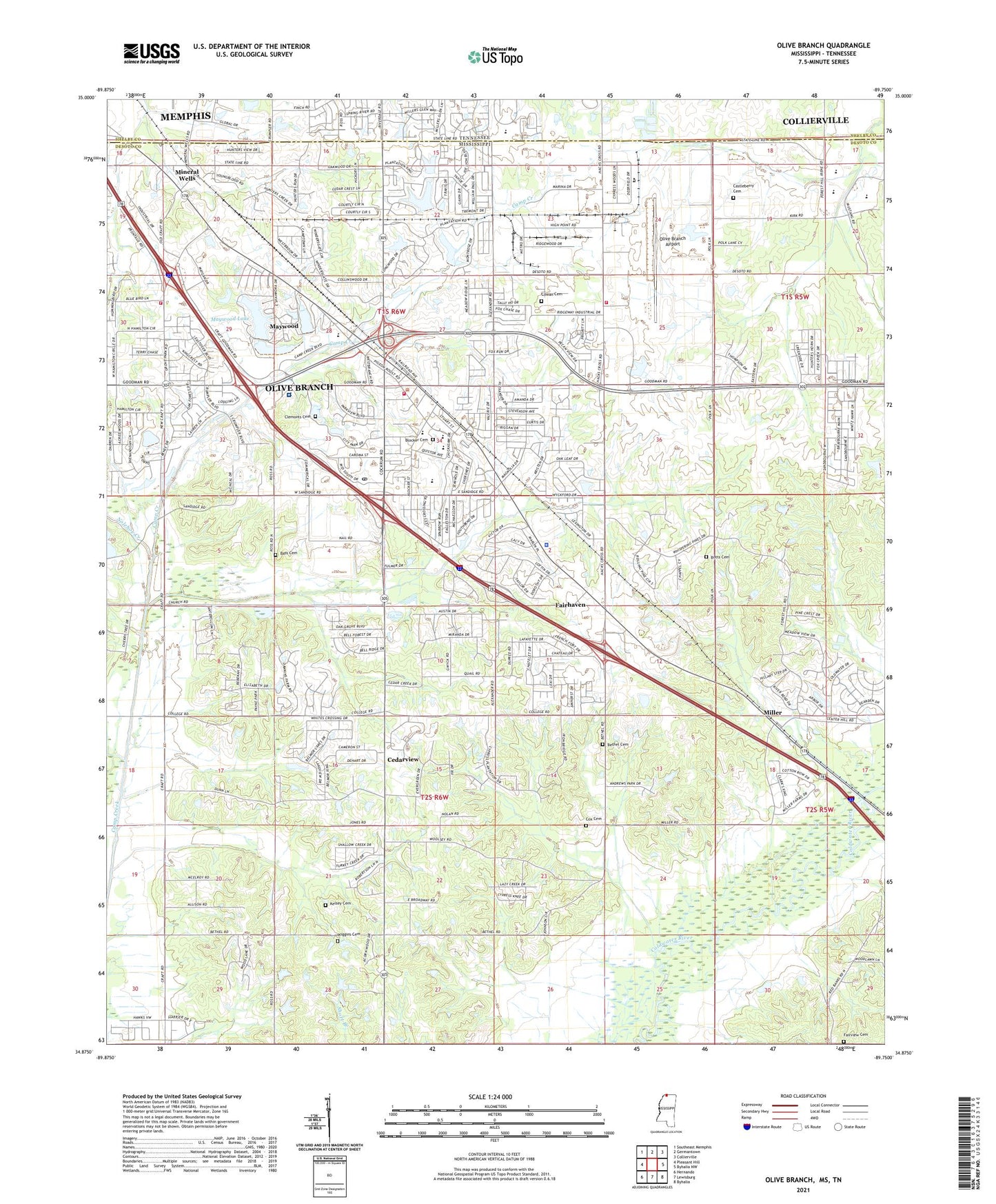
2021 topographic map quadrangle Olive Branch in the states of Mississippi, Tennessee. Scale: 1:24000. Based on the newly updated USGS 7.5' US Topo map series, this map is in the following counties: DeSoto, Shelby. The map contains contour data, water features, and other items you are used to seeing on USGS maps, but also has updated roads and other features. This is the next generation of topographic maps. Printed on high-quality waterproof paper with UV fade-resistant inks.
Quads adjacent to this one:
West: Pleasant Hill
Northwest: Southeast Memphis
North: Germantown
Northeast: Collierville
East: Byhalia NW
Southeast: Byhalia
South: Lewisburg
Southwest: Hernando
Contains the following named places: Bass Cemetery, Bethel Assembly of God Church, Bethel Cemetery, Bethel Church, Bethel Church of the Lord Jesus Christ, Blocker Cemetery, Botts Cemetery, Botts Chapel Missionary Baptist Church, Botts School, Calvary Baptist Church, Calvary Baptist School, Castleberry Cemetery, Cedarview, Cedarview Baptist Church, Chickasaw Elementary School, Church of Christ, Church of God, City of Olive Branch, Clemonts Cemetery, Cowan Cemetery, Cowan School, Cox Cemetery, Davis Field Airport, Fairhaven, Fairhaven Baptist Church, Fairview Cemetery, Fairview Church, First Baptist Church, First Christian Church, Happy Times Day Care Center, Holiday Golf Course, Holy Cross Episcopal Church, Hursts Chapel, Immanuel Baptist Church, Kelly School, Kelsey Cemetery, Lebanon School, Liberty Baptist Church, Maples Learning Center, Maples Memorial United Methodist Church, Maywood, Maywood Lake, Metro Industrial Park, Mid-South Factory Outlet Shopping Center, Miller, Mineral Wells, Mineral Wells Baptist Church, Mineral Wells Methodist Church, Mount Pisgah Missionary Baptist Church, Nolehoe Creek, Northwest Junior College Olive Branch Center, Olive Branch, Olive Branch Airport, Olive Branch Church of Christ, Olive Branch City Hall, Olive Branch Country Club, Olive Branch Elementary School, Olive Branch Fire Department Station 1, Olive Branch Fire Department Station 2, Olive Branch Fire Department Station 3, Olive Branch High School, Olive Branch Industrial Park, Olive Branch Intermediate School, Olive Branch Middle School, Olive Branch Police Department, Olive Branch Post Office, Olive Branch Public Library, Parkwood Behavioral Health System, Payne Church, Payne School, Queen of Peace Catholic Church, Saint Lukes Church of God in Christ, State Line, Sunny Chapel, Supervisor District 1, Wiggins Cemetery, Wiggins Church, ZIP Code: 38654