MyTopo
Onward Mississippi US Topo Map
Couldn't load pickup availability
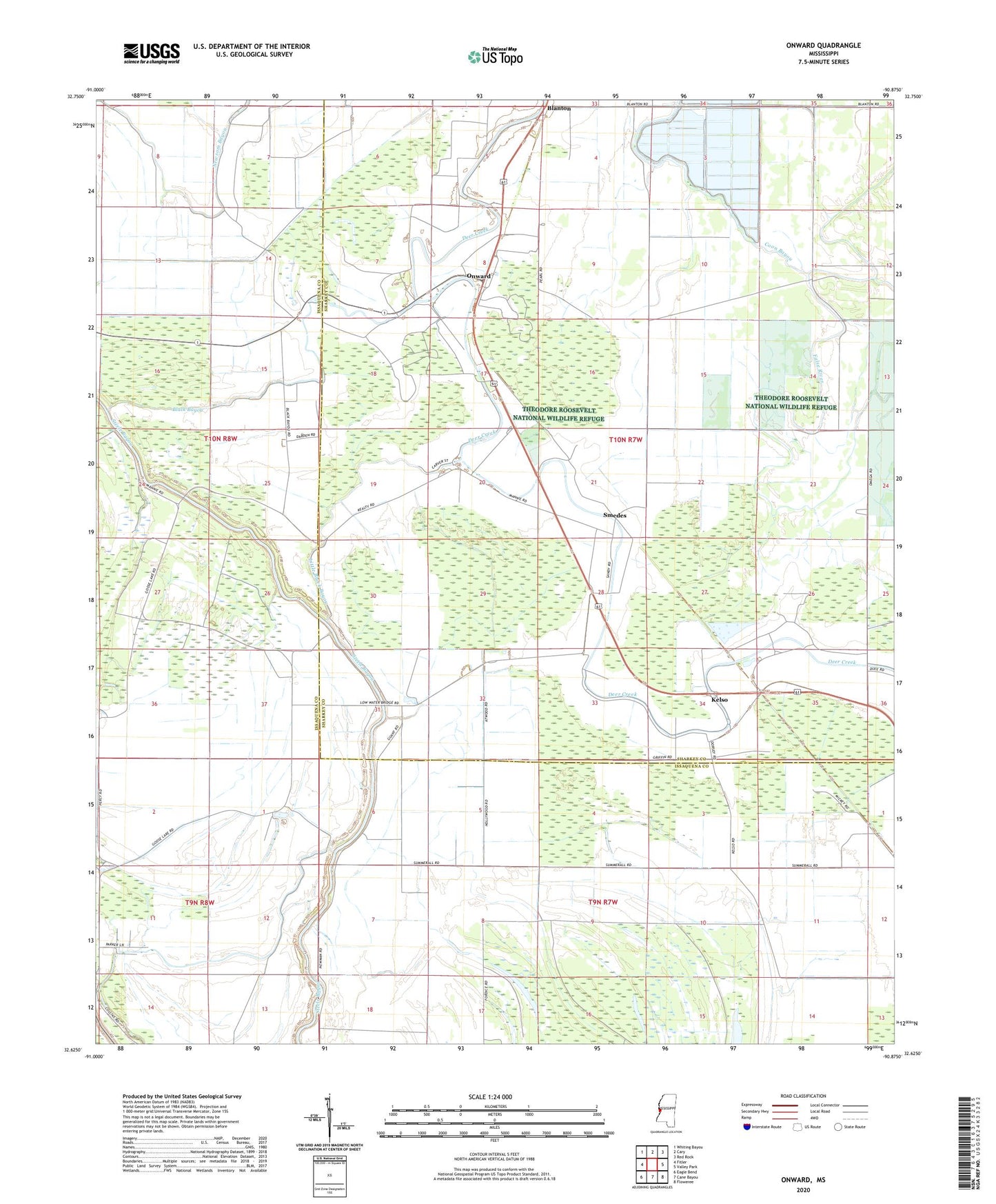
2020 topographic map quadrangle Onward in the state of Mississippi. Scale: 1:24000. Based on the newly updated USGS 7.5' US Topo map series, this map is in the following counties: Issaquena, Sharkey. The map contains contour data, water features, and other items you are used to seeing on USGS maps, but also has updated roads and other features. This is the next generation of topographic maps. Printed on high-quality waterproof paper with UV fade-resistant inks.
Quads adjacent to this one:
West: Fitler
Northwest: Whiting Bayou
North: Cary
Northeast: Red Rock
East: Valley Park
Southeast: Floweree
South: Cane Bayou
Southwest: Eagle Bend
Contains the following named places: Bill Moore Planting Company Pond Dam, Black Bayou, Blanton, Calvary Church, Christian Home Church, Coon Bayou, Issaquena County, Kelso, King David Church, Little Black Bayou, New Bethlehem Church, Onward, Pleasant Grove Church, Priddy Airport, Purddy and Sons Catfish Ponds Dam, Reality Plantation Airport, Rock of Mount Zion Church, Smedes, Supervisor District 2