MyTopo
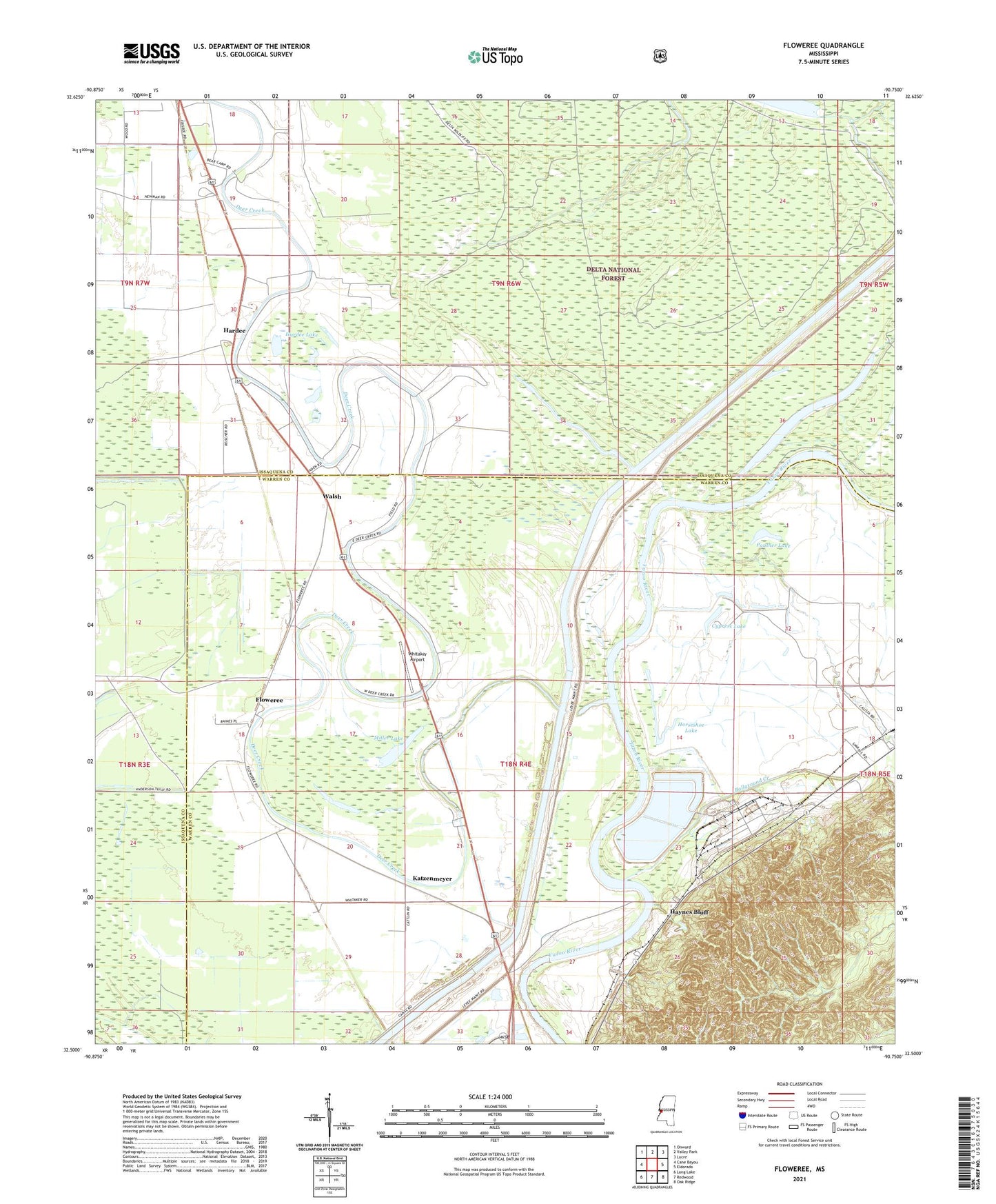
Floweree Mississippi US Topo Map
Couldn't load pickup availability
Also explore the Floweree Forest Service Topo of this same quad for updated USFS data
2024 topographic map quadrangle Floweree in the state of Mississippi. Scale: 1:24000. Based on the newly updated USGS 7.5' US Topo map series, this map is in the following counties: Warren, Issaquena. The map contains contour data, water features, and other items you are used to seeing on USGS maps, but also has updated roads and other features. This is the next generation of topographic maps. Printed on high-quality waterproof paper with UV fade-resistant inks.
Quads adjacent to this one:
West: Cane Bayou
Northwest: Onward
North: Valley Park
Northeast: Lucre
East: Eldorado
Southeast: Oak Ridge
South: Redwood
Southwest: Long Lake
This map covers the same area as the classic USGS quad with code o32090e7.
Contains the following named places: Adams Landing, Ball Ground Creek Landing, Ballground Creek, Cypress Lake, Deer Creek, Evergreen Church, Floweree, Foxs Landing, Greasy Bayou Landing, Greasy Lake, Hardee, Hardee Lake, Haynes Bluff, Haynes Bluff Landing, Horseshoe Lake, International Paper Company Lake Dam, Katzenmeyer, Kemp Marshall Lake, Little Deer Creek Landing, Miller Lake, Morning Star Church, Panther Lake, Paxtons Landing, Saint Paul Church, Supervisor District 2, Walsh, Whitaker Airport, White Stone Church, ZIP Codes: 39156, 39177