MyTopo
Paynes Mississippi US Topo Map
Couldn't load pickup availability
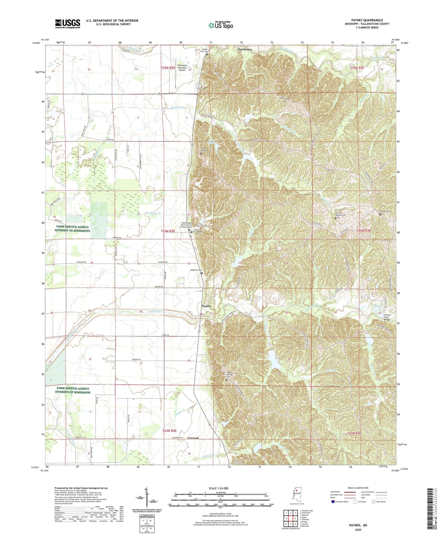
2020 topographic map quadrangle Paynes in the state of Mississippi. Scale: 1:24000. Based on the newly updated USGS 7.5' US Topo map series, this map is in the following counties: Tallahatchie. The map contains contour data, water features, and other items you are used to seeing on USGS maps, but also has updated roads and other features. This is the next generation of topographic maps. Printed on high-quality waterproof paper with UV fade-resistant inks.
Quads adjacent to this one:
West: Tippo
Northwest: Fishhook Lake
North: Charleston
Northeast: Oakland
East: Tillatoba
Southeast: Holcomb
South: Cascilla
Southwest: Philipp
Contains the following named places: Actman Catfish Ponds Dam, Adams Arbor Church of God Prophecy, Adams Arbor Church of God Prophecy Cemetery, Ascalmore Creek Structure Y-17a-11 Dam, Ascalmore Creek Structure Y-17a-2 Dam, Ascalmore Creek Structure Y-17a-5 Dam, Ascalmore Creek Structure Y-17a-71 Dam, Ascalmore Creek Structure Y-17a-72 Dam, Ascalmore Creek Structure Y-17a-73 Dam, Ascalmore Creek Structure Y-17a-76 Dam, Ascalmore Creek Structure YO-30-15 Dam, Ascalmore Creek Structure YO-30-3 Dam, Ascalmore Creek Structure YO-30-4 Dam, Ascalmore Watershed Y-17a-72 Dam, Blue Cane Church, Camp Talla Refuge, Carver Hill Cemetery, Charleston Municipal Airport, Church of God, Corinth Baptist Cemetery, Corinth Baptist Church, Corinth Cemetery, Gentry Ford Bridge, Hubbard Creek, Hunter Creek, James Lake Dam, Jerusalem Church, Jordan Hill Cemetery, Lake Tallaha, Leverett, Little Hubbard Church, Magnolia Cemetery, New Life Church, Parker Branch, Paynes, Paynes Church, Paynes Fire Department, Poplar Springs Cemetery, Powers Creek, Providence Church, Rocky Spring Church, Rowland Branch, Rowland Cemetery, Shook Creek, Taylors Chapel, Union Grove Church, Young Creek