MyTopo
Fishhook Lake Mississippi US Topo Map
Couldn't load pickup availability
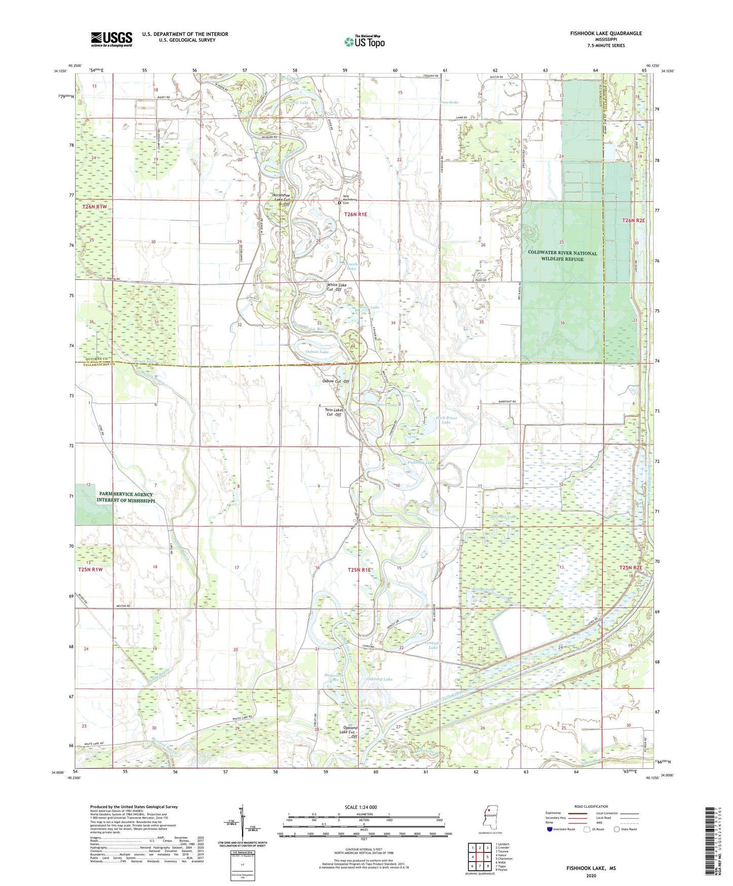
2024 topographic map quadrangle Fishhook Lake in the state of Mississippi. Scale: 1:24000. Based on the newly updated USGS 7.5' US Topo map series, this map is in the following counties: Tallahatchie, Quitman. The map contains contour data, water features, and other items you are used to seeing on USGS maps, but also has updated roads and other features. This is the next generation of topographic maps. Printed on high-quality waterproof paper with UV fade-resistant inks.
Quads adjacent to this one:
West: Vance
Northwest: Lambert
North: Crowder
Northeast: Tocowa
East: Charleston
Southeast: Paynes
South: Tippo
Southwest: Webb
This map covers the same area as the classic USGS quad with code o34090a2.
Contains the following named places: Black Bayou, Black Lake, Boyce Lake, Brushy Bayou, Burnt Brake, Clear Creek Church, Coldwater River National Wildlife Refuge, Croudip Lake, Dry Bayou, Dry Bayou Plantation, Duck Roost Lake, Fishhook Lake, Horseshoe Lake, Horseshoe Lake Cut -Off, Houston School, Hurricane Bayou, Little Frazier Bayou, Muddy Bayou, New Macedonia Cemetery, New Macedonia Church, Oakland Lake, Oakland Lake Cut -Off, Oxbow Cut -Off, Oxbow Lake, Oxbows Landing, Patterson Lakes, Puncheon Bayou, Round Lake, Stovall Bayou, Stringer Lake, Supervisor District 2, Thorn Lake, Tillatoba Creek, Twin Lake, Twin Lakes Cut -Off, White Lake, White Lake Church, White Lake Cut -Off, Yonkapin Lake