MyTopo
Pine Valley Mississippi US Topo Map
Couldn't load pickup availability
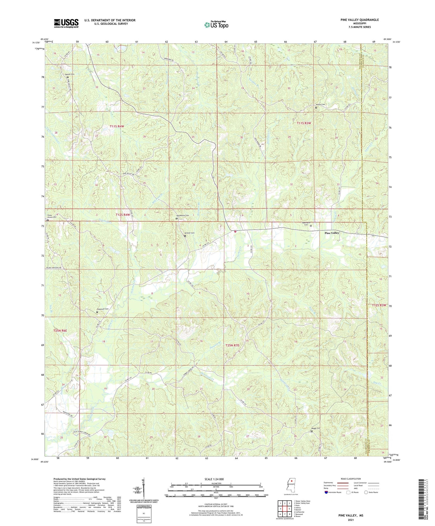
2021 topographic map quadrangle Pine Valley in the state of Mississippi. Scale: 1:24000. Based on the newly updated USGS 7.5' US Topo map series, this map is in the following counties: Yalobusha, Calhoun. The map contains contour data, water features, and other items you are used to seeing on USGS maps, but also has updated roads and other features. This is the next generation of topographic maps. Printed on high-quality waterproof paper with UV fade-resistant inks.
Quads adjacent to this one:
West: Velma
Northwest: Water Valley West
North: Water Valley East
Northeast: Paris
East: Banner
Southeast: Skuna
South: Benwood
Southwest: Coffeeville
Contains the following named places: Bethel Cemetery, Bethel Church, Brower Cemetery, Browers Branch, Coleman Creek, Hopewell Cemetery, Hopewell Church, Hurricane Creek, Jew Branch, Macedonia Cemetery, Meggs Cemetery, Mill Pond Branch, Oak Grove School, Pine Valley, Pine Valley School, Pine Valley Volunteer Fire Department, Piney Grove Cemetery, Piney Grove Church, Saunders Creek, Simpson Branch, Supervisor District 1, Supervisor District 2, Tabernacle Cemetery, Tabernacle Church, Turkey Creek Structure Y-20-51 Dam, Turkey Creek Structure Y-20-57 Dam, Ware Branch, Wilson Cemetery