MyTopo
Purvis Mississippi US Topo Map
Couldn't load pickup availability
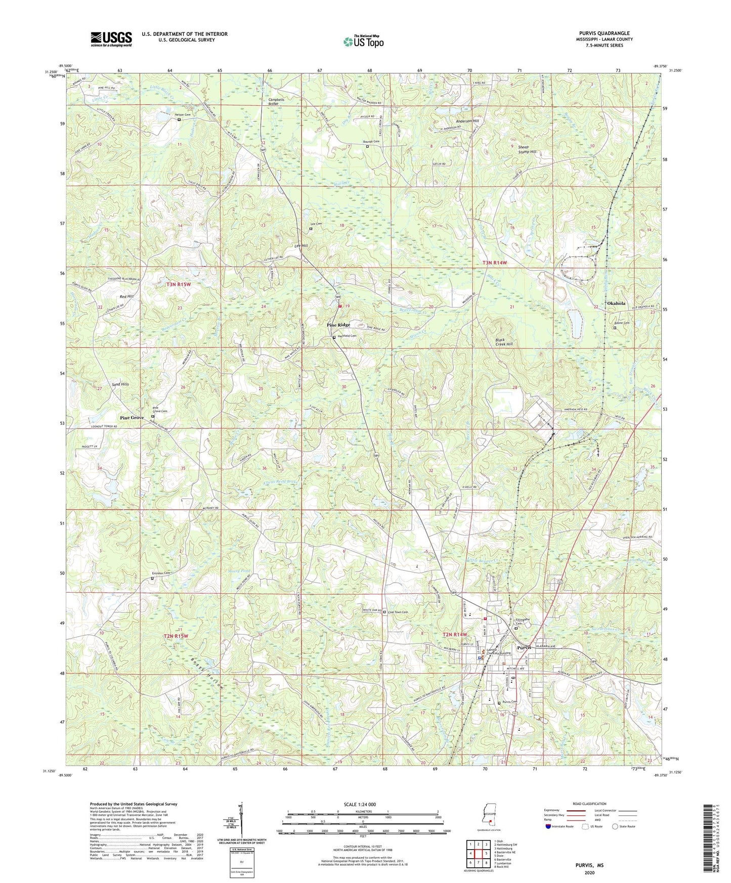
2020 topographic map quadrangle Purvis in the state of Mississippi. Scale: 1:24000. Based on the newly updated USGS 7.5' US Topo map series, this map is in the following counties: Lamar. The map contains contour data, water features, and other items you are used to seeing on USGS maps, but also has updated roads and other features. This is the next generation of topographic maps. Printed on high-quality waterproof paper with UV fade-resistant inks.
Quads adjacent to this one:
West: Baxterville NE
Northwest: Oloh
North: Hattiesburg SW
Northeast: Hattiesburg
East: Dixie
Southeast: Rock Hill
South: Lumberton
Southwest: Baxterville
Contains the following named places: Allens Reed Brake, Anderson Hill, Beaverdam Creek, Bennetts Memorial Park, Bethlehem Missionary Baptist Church, Black Creek Hill, Black Creek Refinery, Boggy Branch, Boone Cemetery, Bounds Cemetery, Burnt Bridge Church, Campbells Bridge, Central Church, Charles Roseberry Pond Dam, City of Purvis, Coal Town Cemetery, Cow Branch, Daniels Reed Brake, Dry Branch, Earnest Anderson Dam, Entrekin Cemetery, Ephesus Church, Fillingame Cemetery, First Baptist Church, Good Hope Baptist Church, Good Hope School, Hartfield Cemetery, Hudson Creek, Lamar County Emergency, Lamar County Industrial Park, Lamar County Sheriff's Office, Lee Cemetery, Lee Hill, Lee School, Little Black Creek, Little Creek, Mill Branch, Mill Creek, Mixon Creek, Morrow Branch, Mossy Pond, Mount Hebron Church, Nelson Cemetery, Okahola, Okahola Baptist Church, Perkins Creek, Pine Grove, Pine Grove Baptist Church, Pine Grove Cemetery, Pine Ridge, Pine Ridge Volunteer Fire Department, Purvis, Purvis Cemetery, Purvis City Hall, Purvis Elementary School, Purvis Fire Department, Purvis Fire Department Administration, Purvis High School, Purvis Police Department, Purvis Post Office, Purvis United Methodist Church, Red Hill, Reeves Branch, Sand Hills, Sandy Run, Sheep Stomp Hill, South Mississippi Electric Power Association Dam, South Mississippi State Hospital, Southern Pine Hills, Spring Creek, Tan Trough Creek, Tommy Smith Lake Dam, Trace Branch, ZIP Code: 39475