MyTopo
Oloh Mississippi US Topo Map
Couldn't load pickup availability
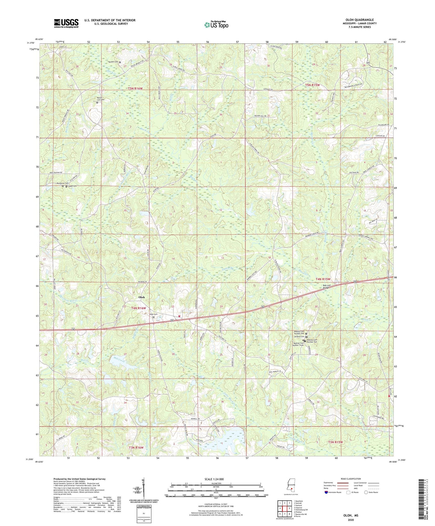
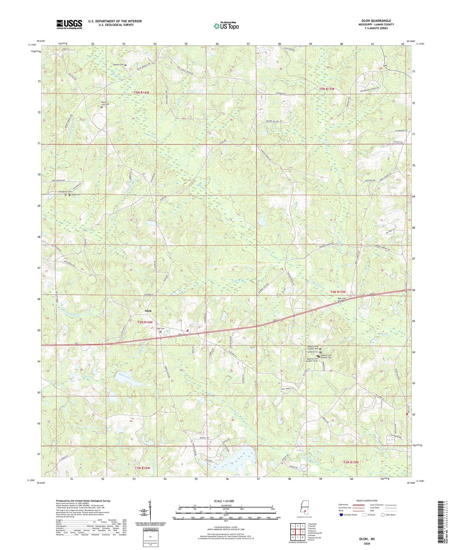
2024 topographic map quadrangle Oloh in the state of Mississippi. Scale: 1:24000. Based on the newly updated USGS 7.5' US Topo map series, this map is in the following counties: Lamar. The map contains contour data, water features, and other items you are used to seeing on USGS maps, but also has updated roads and other features. This is the next generation of topographic maps. Printed on high-quality waterproof paper with UV fade-resistant inks.
Quads adjacent to this one:
West: Improve
Northwest: Bassfield
North: Sumrall
Northeast: Sanford
East: Hattiesburg SW
Southeast: Purvis
South: Baxterville NE
Southwest: Pinebur
This map covers the same area as the classic USGS quad with code o31089c5.
Contains the following named places: Baptist Branch, Bear Bay, Bob Lott Bridge, Buchanan Cemetery, Central Lamar County Fire Department, Clyde Camp, Doctor Richard Clark Pond Dam, Dogwood Island, Irby-Alexander Pond Dam, J D Broome Pond Dam, Martin - Lott Cemetery, Midway Cemetery Number One, Midway Cemetery Number Three, Midway Cemetery Number Two, Midway Church, Midway School, Mill Creek, Monroe Creek, Olah Lookout Tower, Oloh, Oloh Baptist Church, Oloh Cemetery, Oloh Volunteer Fire Department, Powell School, Robert Lotts, Russell Cemetery, Slade Cemetery, Supervisor District 4, Supervisor District 5, Turkey Branch, West Black Creek Church, ZIP Code: 39482