MyTopo
Dixie Mississippi US Topo Map
Couldn't load pickup availability
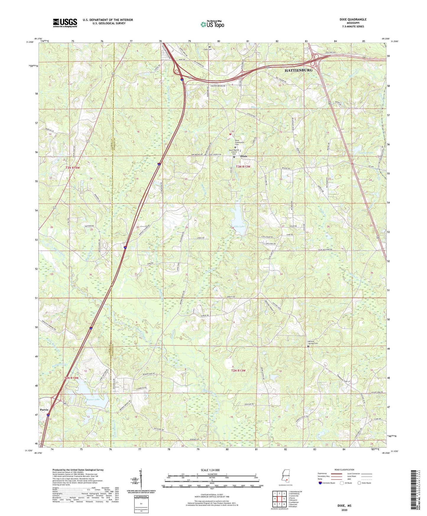
2024 topographic map quadrangle Dixie in the state of Mississippi. Scale: 1:24000. Based on the newly updated USGS 7.5' US Topo map series, this map is in the following counties: Forrest, Lamar. The map contains contour data, water features, and other items you are used to seeing on USGS maps, but also has updated roads and other features. This is the next generation of topographic maps. Printed on high-quality waterproof paper with UV fade-resistant inks.
Quads adjacent to this one:
West: Purvis
Northwest: Hattiesburg SW
North: Hattiesburg
Northeast: Carterville
East: McLaurin
Southeast: Brooklyn
South: Rock Hill
Southwest: Lumberton
This map covers the same area as the classic USGS quad with code o31089b3.
Contains the following named places: Beaver Lake, Bellecrest Mobile Home Village, Black Tom Creek, Browns School, Bufkins Branch, Central Forrest Attendance Center, Clark Cemetery, Clear Creek, Dixie, Dixie Baptist Church, Dixie Baptist Church Cemetery, Dixie Recreation Center, Dixie United Methodist Church, Dixie Volunteer Fire Department, Elk Lake Dam, Elks Lake, Forrest County, Interstate 59 North Roadside Park, Lake Beaver Dam, Mineral Springs Baptist Church, Mineral Springs Cemetery, Pine Creek Golf Club, Pineview Baptist Church, Rodgers School, Sumrall Lake, Supervisor District 1, Sweatmans Creek, Whites Chapel, ZIP Code: 39401