MyTopo
Puskus Lake Mississippi US Topo Map
Couldn't load pickup availability
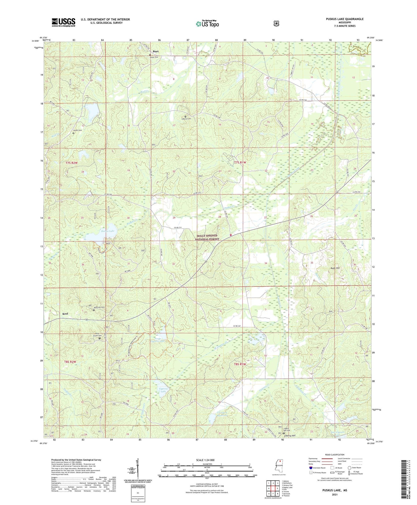
2021 topographic map quadrangle Puskus Lake in the state of Mississippi. Scale: 1:24000. Based on the newly updated USGS 7.5' US Topo map series, this map is in the following counties: Lafayette, Marshall. The map contains contour data, water features, and other items you are used to seeing on USGS maps, but also has updated roads and other features. This is the next generation of topographic maps. Printed on high-quality waterproof paper with UV fade-resistant inks.
Quads adjacent to this one:
West: Bagley Lake
Northwest: Malone
North: Bethlehem
Northeast: Hickory Flat
East: Etta
Southeast: Thaxton
South: Denmark
Southwest: Yocona
Contains the following named places: Bethlehem Church, Burt, Cambridge, Cambridge Lake, Caswell, Caswell School, Christian Rest Church, Coffey School, Cypress Lake, Cypress Springs School, Cypress Watershed LT-14a-10 Dam, Cypress Watershed LT-14a-11 Dam, Cypress Watershed LT-14a-12 Dam, Cypress Watershed LT-14a-14 Dam, East Cypress Creek, Flint Hill Church, Flint Hill School, Goolsby Store, Jefferson Cemetery, Jefferson Church, Keel, Kilgore, Lafayette County Fire Department Station 12 Philadelphia, Liberty Cemetery, Liberty Hill, Liberty Hill Cemetery, LT-14a-1 Dam, LT-14a-2 Dam, LT-14a-3 Dam, LT-14a-4 Dam, LT-14a-4 Reservoir, Mayfield Store, New Liberty Hill Church, Noah, North Cypress Lake, Parks Store, Philadelphia Baptist Church, Philadelphia School, Pine Grove Cemetery, Pritchard School, Puskus Creek, Puskus Lake, Puskus Lake Recreation Area, Rock Hill School, Rook Hill, Shiloh Cemetery, Smith Cemetery, Spring Hill School, Stones Store, Supervisor District 2, Union Hill Missionary Baptist Church, Walton, West Cypress Creek, Windham School