MyTopo
Hickory Flat Mississippi US Topo Map
Couldn't load pickup availability
Also explore the Hickory Flat Forest Service Topo of this same quad for updated USFS data
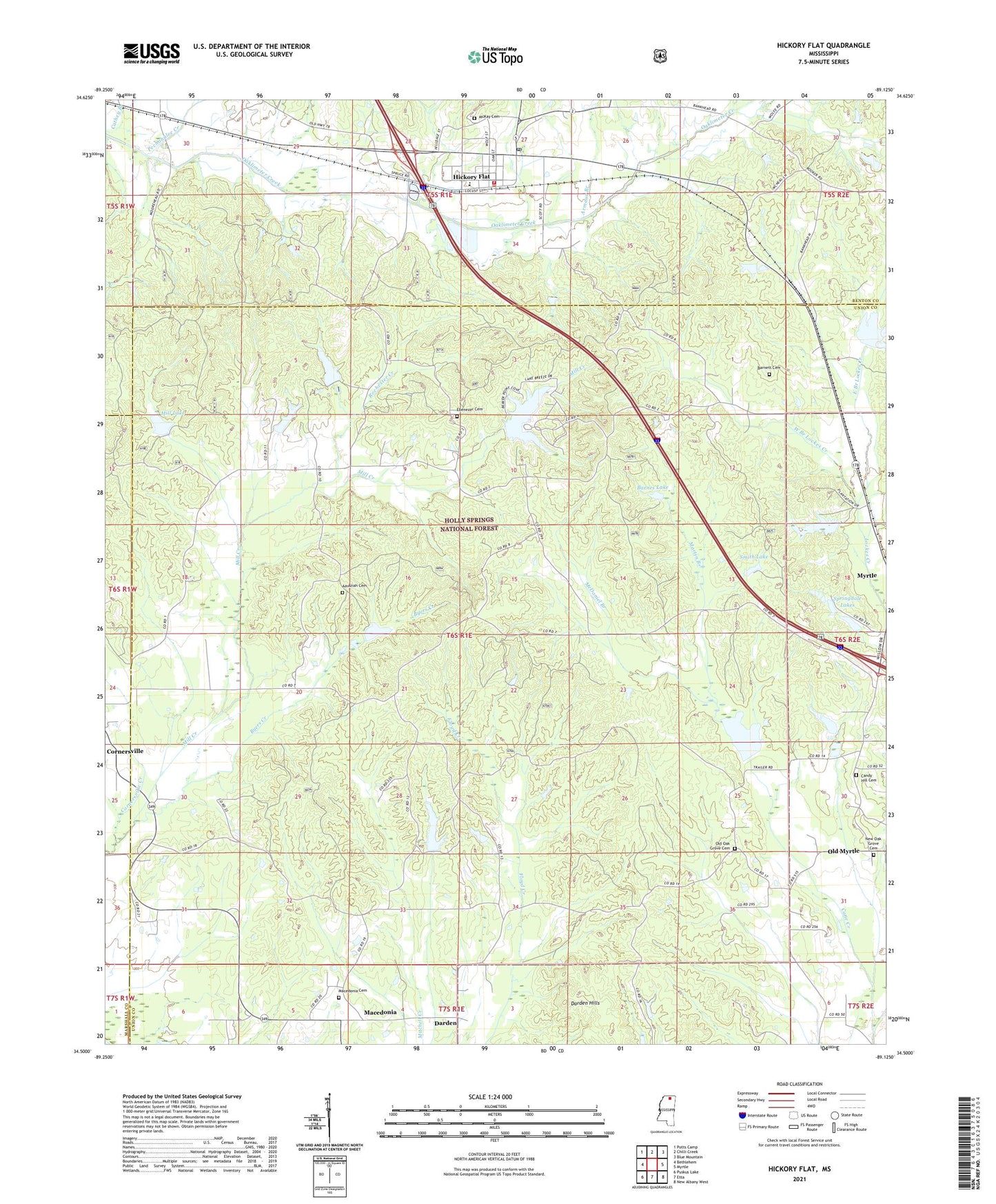
2024 topographic map quadrangle Hickory Flat in the state of Mississippi. Scale: 1:24000. Based on the newly updated USGS 7.5' US Topo map series, this map is in the following counties: Union, Benton, Marshall. The map contains contour data, water features, and other items you are used to seeing on USGS maps, but also has updated roads and other features. This is the next generation of topographic maps. Printed on high-quality waterproof paper with UV fade-resistant inks.
Quads adjacent to this one:
West: Bethlehem
Northwest: Potts Camp
North: Chilli Creek
Northeast: Blue Mountain
East: Myrtle
Southeast: New Albany West
South: Etta
Southwest: Puskus Lake
This map covers the same area as the classic USGS quad with code o34089e2.
Contains the following named places: Amaziah Cemetery, Amaziah Church, Armour Branch, Arrowhead Lake Dam, Baird Lake Dam, Ballard Pond Dam, Barnes Lake, Barnett Cemetery, Byers Creek, Candy Hill Cemetery, Cane Creek, Cathey Branch, Community Church, Cornersville Creek, Darden, Darden Hills, East Branch Lockes Creek, Ebenezer Cemetery, Ebenezer Church, Hickory Flat, Hickory Flat Post Office, Hickory Flat School, Hickory Flat Volunteer Fire Department, Lake Arrowhead, Locks Watershed LT-9a-1 Dam, Locks Watershed LT-9a-3 Dam, LT 8-17 Dam, LT 8-17 Lake, Macedonia, Macedonia Cemetery, Macedonia Church, Martin Branch, McDaniel Branch, McKay Cemetery, Mill Lake, Mill Watershed LT-14b-1 Dam, Mill Watershed LT-14b-2 Dam, Mill Watershed LT-14b-5 Dam, Myrtle Lookout Tower, New Oak Grove Cemetery, New Oak Grove Church, Oco, Old Oak Grove Cemetery, Old Oak Grove Church, Pechahalee Creek, Rochester Creek, Smith Lake, Spencer Lake Dam, Springdale Lake Dam, Springdale Lakes, Supervisor District 1, Town of Hickory Flat, Turkland, West Branch Lockes Creek, ZIP Code: 38650