MyTopo
Ratliff Mississippi US Topo Map
Couldn't load pickup availability
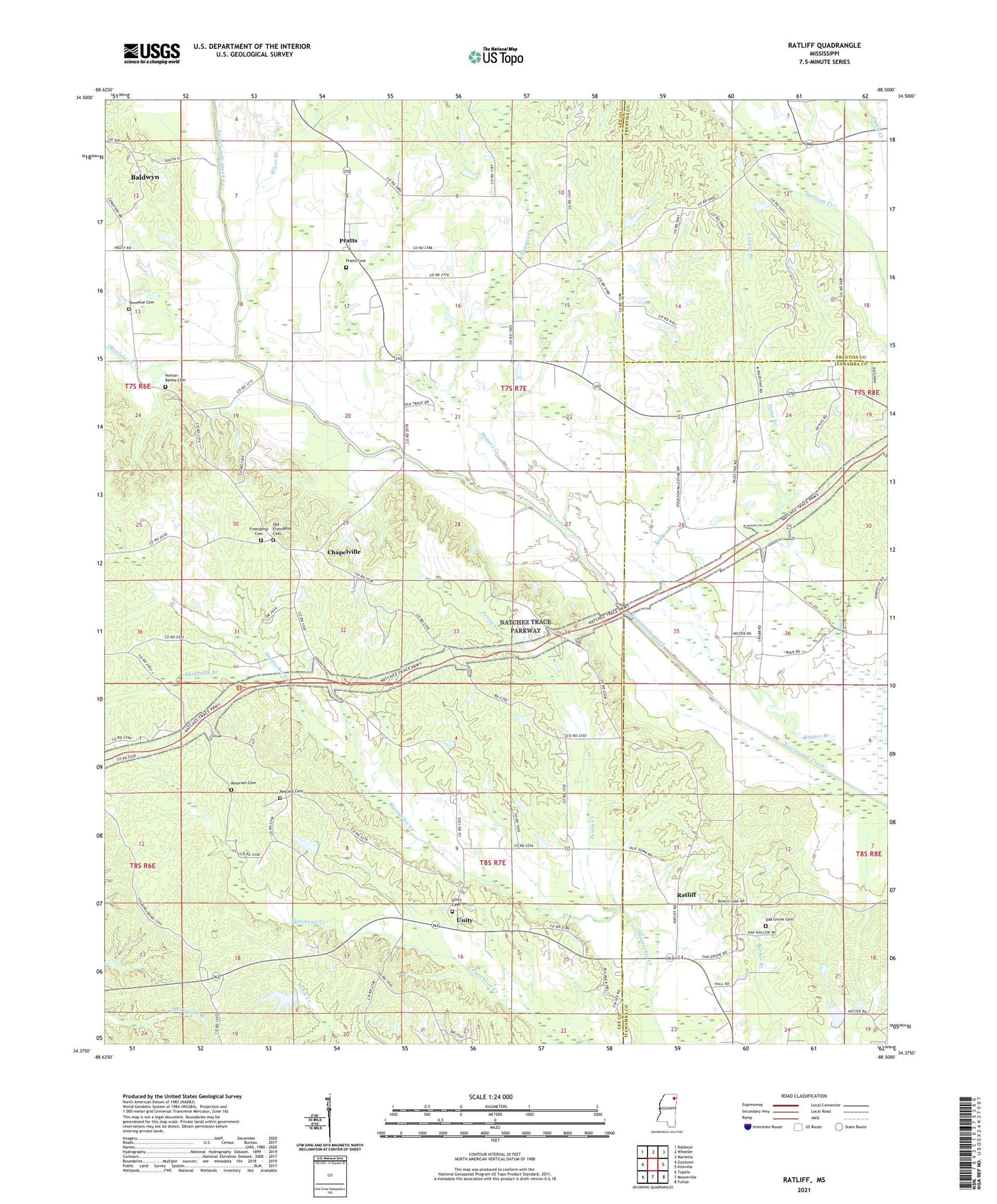
2024 topographic map quadrangle Ratliff in the state of Mississippi. Scale: 1:24000. Based on the newly updated USGS 7.5' US Topo map series, this map is in the following counties: Lee, Itawamba, Prentiss. The map contains contour data, water features, and other items you are used to seeing on USGS maps, but also has updated roads and other features. This is the next generation of topographic maps. Printed on high-quality waterproof paper with UV fade-resistant inks.
Quads adjacent to this one:
West: Guntown
Northwest: Baldwyn
North: Wheeler
Northeast: Marietta
East: Kirkville
Southeast: Fulton
South: Mooreville
Southwest: Tupelo
This map covers the same area as the classic USGS quad with code o34088d5.
Contains the following named places: Carnes School, Chapelville, Church of God, Dugger Creek, East Mount Zion Church, Franklin Nichols Pond Dam, Friendship Cemetery, Friendship Church, Horton-Bailey Cemetery, New Dawn Church, Oak Grove Cemetery, Oak Grove Church, Okeelala Creek, Old Friendship Cemetery, Palestine Church, Palestine School, Parkers Chapel, Penny Creek, Peterson Cemetery, Plumorchard Branch, Pratt School, Pratts, Pratts Cemetery, Pratts Church, Pritchard Lake Dam, Ratliff, Red Hill Cemetery, Red Hill School, Silver Branch, South Prentiss Church, South Prentiss School, Supervisor District 1, Tennelue Cemetery, Tennie Lou Church, Threemile Branch, Unity, Unity Cemetery, Unity Church, Whitley School, Yeager Branch