MyTopo
Ruth Mississippi US Topo Map
Couldn't load pickup availability
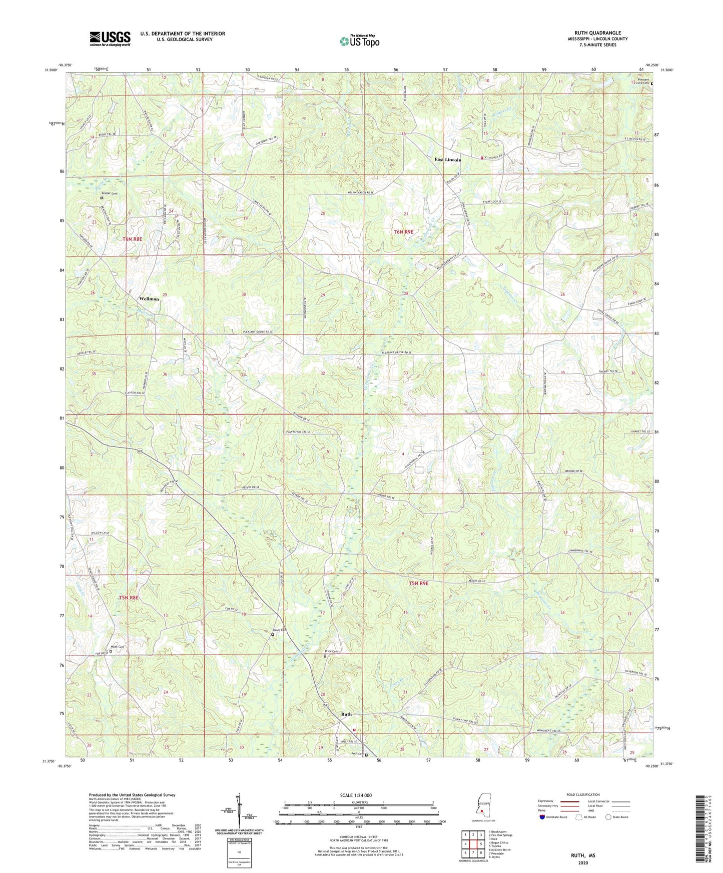
2020 topographic map quadrangle Ruth in the state of Mississippi. Scale: 1:24000. Based on the newly updated USGS 7.5' US Topo map series, this map is in the following counties: Lincoln. The map contains contour data, water features, and other items you are used to seeing on USGS maps, but also has updated roads and other features. This is the next generation of topographic maps. Printed on high-quality waterproof paper with UV fade-resistant inks.
Quads adjacent to this one:
West: Bogue Chitto
Northwest: Brookhaven
North: Fair Oak Springs
Northeast: Nola
East: Topeka
Southeast: Jayess
South: Pricedale
Southwest: McComb North
Contains the following named places: Bailey Branch School, Brents Mill, Brister Cemetery, Bristerville, Caseyville, East Lincoln, East Lincoln Baptist Church, East Lincoln Consolidated School, East Lincoln Volunteer Fire Department, Mars Hill Church, Moak Cemetery, Pleasant Grove Cemetery, Price Cemetery, Rawls Cemetery, Ruth, Ruth Baptist Church, Ruth Cemetery, Ruth Church, Ruth Lookout Tower, Ruth School, Ruth Volunteer Fire Department, Shacks, Sweetwater School, Topisaw Church, Van Hatcher Lake Dam, Wellman, Wellman Baptist Church, ZIP Code: 39662