MyTopo
Pricedale Mississippi US Topo Map
Couldn't load pickup availability
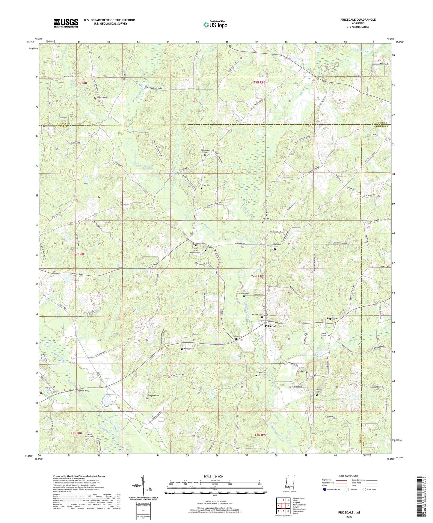
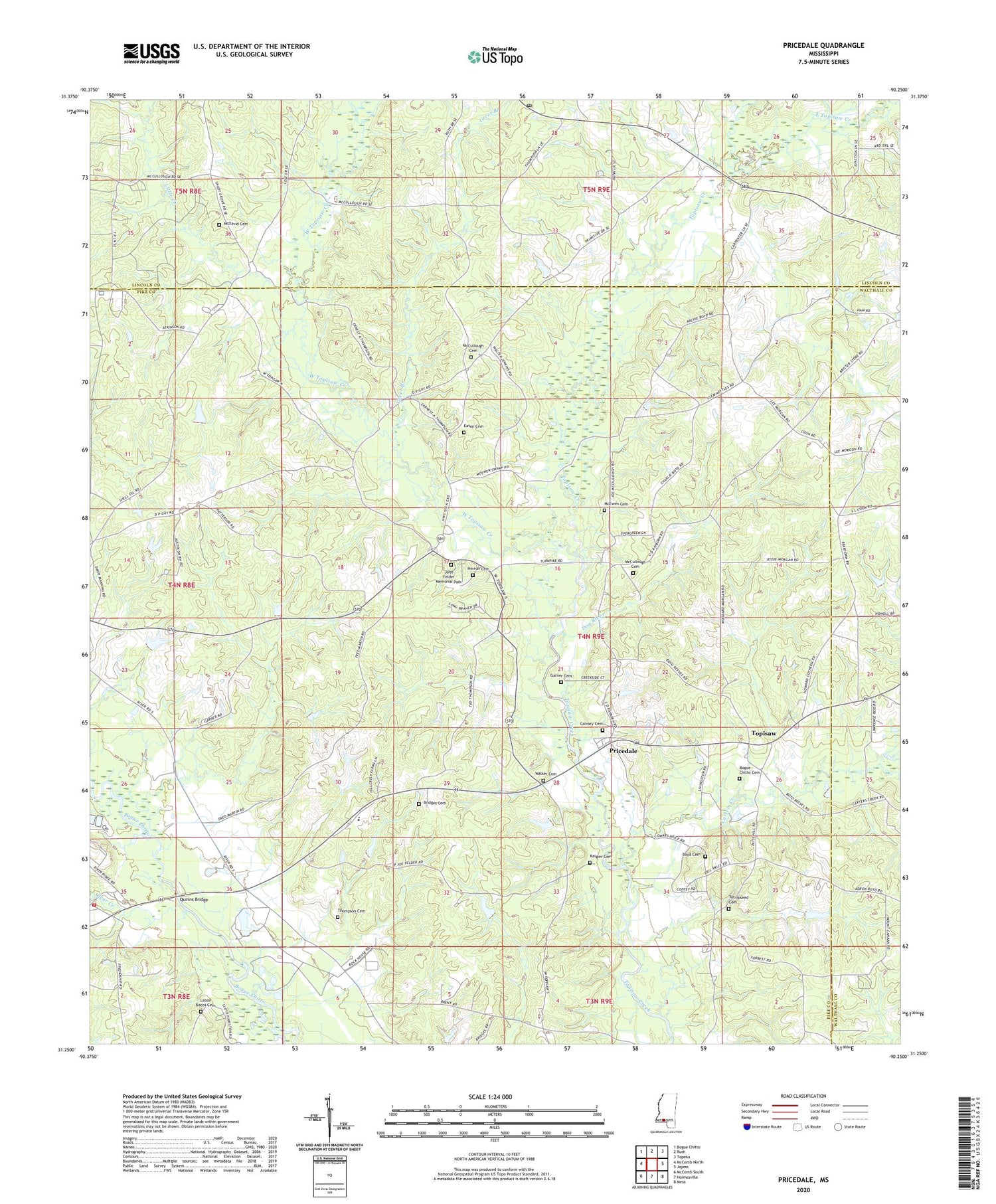
2024 topographic map quadrangle Pricedale in the state of Mississippi. Scale: 1:24000. Based on the newly updated USGS 7.5' US Topo map series, this map is in the following counties: Pike, Lincoln, Walthall. The map contains contour data, water features, and other items you are used to seeing on USGS maps, but also has updated roads and other features. This is the next generation of topographic maps. Printed on high-quality waterproof paper with UV fade-resistant inks.
Quads adjacent to this one:
West: McComb North
Northwest: Bogue Chitto
North: Ruth
Northeast: Topeka
East: Jayess
Southeast: Mesa
South: Holmesville
Southwest: McComb South
This map covers the same area as the classic USGS quad with code o31090c3.
Contains the following named places: Bogue Chitto Baptist Church, Bogue Chitto Cemetery, Boyd Cemetery, Bridges Cemetery, Calvary Baptist Church, Calvary Cemetery, Carters Creek, Clear Creek, Dog River, East Topisaw Creek, Eaton Cemetery, Felders Campground, Felders Mill, Friendship Church, Friendship Volunteer Fire Department, Garner Cemetery, Greer Branch, Guy Lake Dam, Herron Cemetery, John Felder Memorial Park, Kaigler Cemetery, Labon Bacot Cemetery, Little Creek, Little Creek Oil Field, Mars Hill Church, McCullough Cemetery, McDavid Cemetery, McEwen Cemetery, Mount Zion Church, New Zion Church, North Pike Middle School, Nunnery Lake Dam, Pinehaven Lake Dam, Pricedale, Quinns Bridge, Ruth Post Office, Shady Grove Church, Spring Beulah Church, Spring Lake Dam, Spring Leaf Church, Spring Leaf School, Thompson Cemetery, Topisaw, Turnipseed Cemetery, Union Primitive Church, Walker Cemetery, WCCA-FM (Mccomb), West Topisaw Creek