MyTopo
Sardis Dam Mississippi US Topo Map
Couldn't load pickup availability
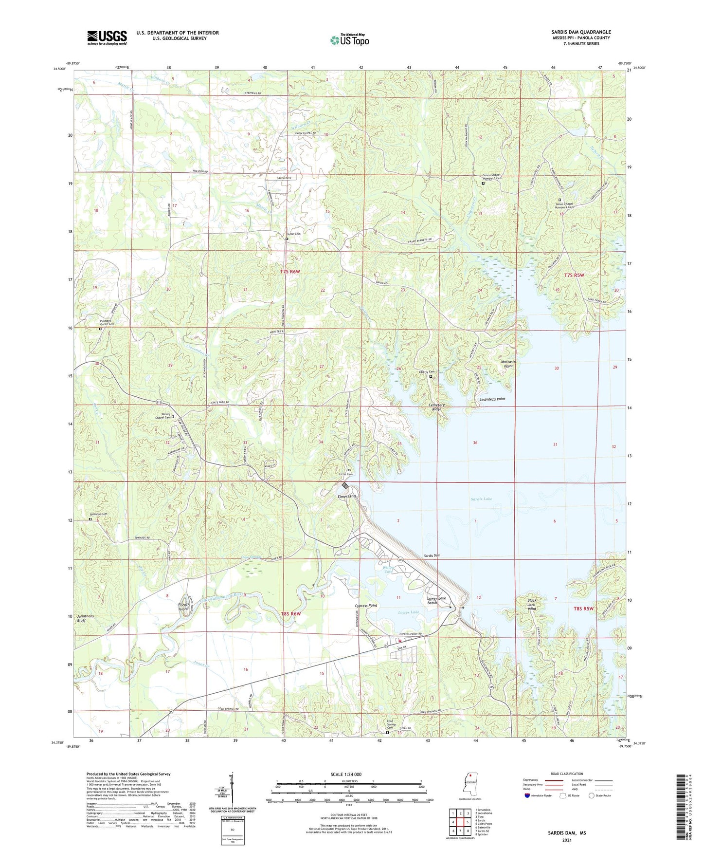
2024 topographic map quadrangle Sardis Dam in the state of Mississippi. Scale: 1:24000. Based on the newly updated USGS 7.5' US Topo map series, this map is in the following counties: Panola. The map contains contour data, water features, and other items you are used to seeing on USGS maps, but also has updated roads and other features. This is the next generation of topographic maps. Printed on high-quality waterproof paper with UV fade-resistant inks.
Quads adjacent to this one:
West: Sardis
Northwest: Senatobia
North: Looxahoma
Northeast: Tyro
East: Coles Point
Southeast: Splinter
South: Sardis SE
Southwest: Batesville
This map covers the same area as the classic USGS quad with code o34089d7.
Contains the following named places: Beach Point Public Use Area, Belmont Cemetery, Black Jack Point, Black Jack Point Public Use Area, Blakely School, Bratton Store, Cemetery Ridge, Clarendon Creek, Clear Springs, Cold Springs Cemetery, Cold Springs Church, Coleman Creek, Cypress Point, Cypress Point Public Use Area, D R Houpt Pond Dam, Dave Pointer Pond Dam, Dunnigan Chapel, Elmers Hill, Engineer Point Public Use Area, Floyds Island, Guy Hyde Pond Dam, Hayes Crossing, Hayes Crossing Public Use Area, Hideaway Hills, J P Phillips Junior Pond Dam, John W Kyle State Park, Jones Creek, Lespedeza, Lespideza Point, Lespideza Point Public Use Area, Liberty Cemetery, Little Cemetery, Lower Lake, Lower Lake Beach, Lower Lake Beach Public Use Area, Moccasin Point, Moccasin Point Public Use Area, Nelson Creek, Orr Creek, Patton Creek, Pleasant Green Cemetery, Pleasant Green Church, Pleasant Green School, Rainey Branch, Saint Peter Church, Sardis Dam, Sardis Lower Lake Fire Department, Shady Cove Public Use Area, Simon Chapel Number 1, Simon Chapel Number 1 Cemetery, Simon Chapel Number 1 School, Simon Chapel Number 2, Simon Chapel Number 2 Cemetery, Spring Hill Church, Thompson Creek, Thompson Creek Landing Public Use Area, Thompson Creek Lodge, Union Baptist Church, Union Cemetery, Union Church, Union School, Wesley Chapel, Wesley Chapel Cemetery, Willow Cove, Willow Cove Public Use Area, Zion Hill Church, Zion Hill School