MyTopo
Satartia Mississippi US Topo Map
Couldn't load pickup availability
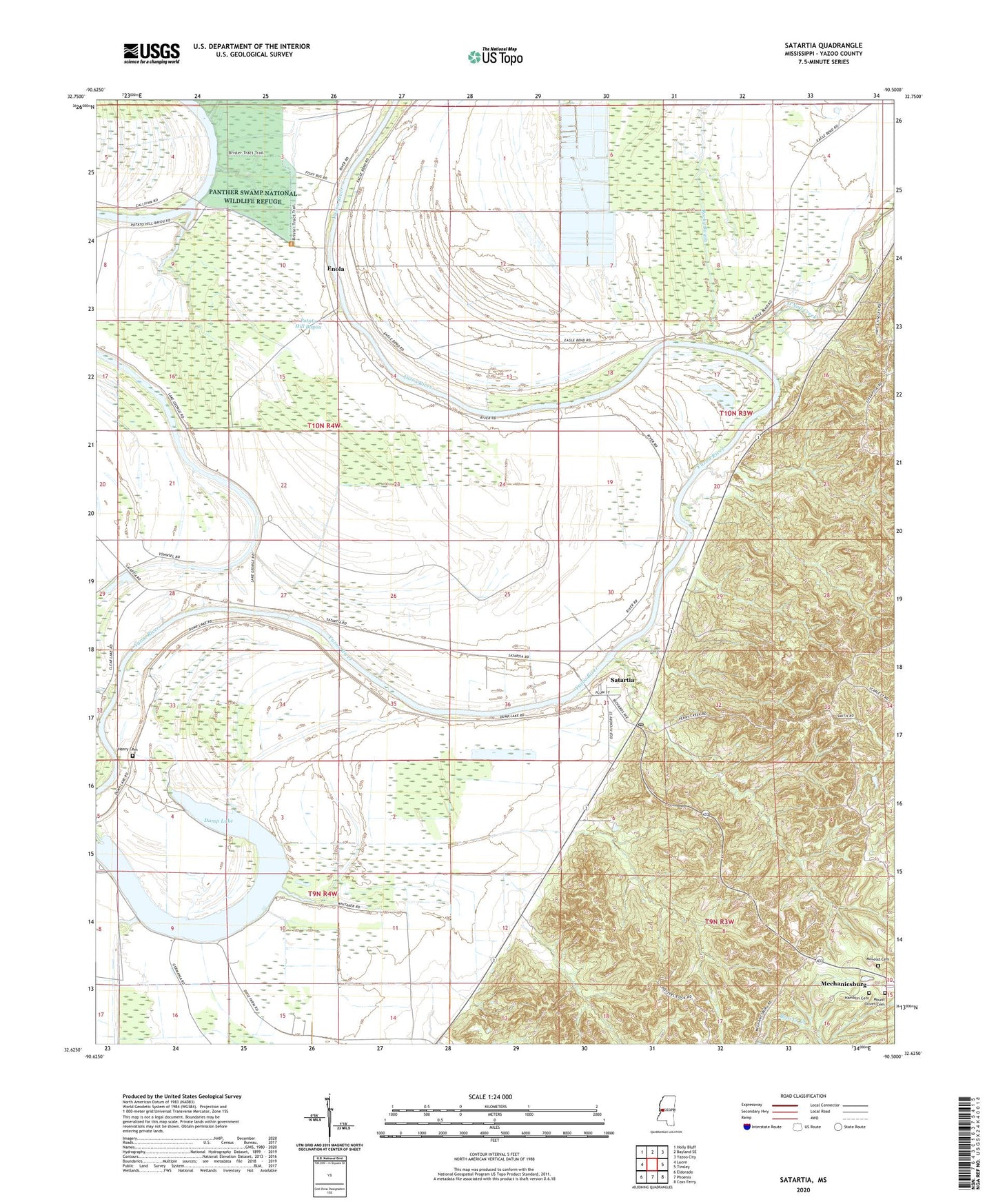
2020 topographic map quadrangle Satartia in the state of Mississippi. Scale: 1:24000. Based on the newly updated USGS 7.5' US Topo map series, this map is in the following counties: Yazoo. The map contains contour data, water features, and other items you are used to seeing on USGS maps, but also has updated roads and other features. This is the next generation of topographic maps. Printed on high-quality waterproof paper with UV fade-resistant inks.
Quads adjacent to this one:
West: Lucre
Northwest: Holly Bluff
North: Bayland SE
Northeast: Yazoo City
East: Tinsley
Southeast: Coxs Ferry
South: Phoenix
Southwest: Eldorado
Contains the following named places: Adybos Landing, Anderson Creek Landing, Bradens Landing, Dump Lake, Eagle Bend Landing, Enola, Enola Landing, Ewings Landing, Gales Landing, Ganderslaugh Landing, Hamblin Cemetery, Harbins Landing, Hard Times Landing, Henry Cemetery, Holly Bend Landing, Hopewell Landing, Kincades Landing, Lake Dick Dam, Lake Dick Landing, Lake George Landing, Liverpool, Liverpool Church, Liverpool Landing, Llanda Landing, McLeod Cemetery, Mechanicsburg, Melrose Landing, Melrose Plantation, Miles Landing, Mount Oliver Church, Mount Olivet Cemetery, New Hope Church, O'Neals Creek Landing, O'Neil Creek, Peaster Catfish Ponds Dam, Pleasant Green Landing, Potato Hill Bayou, Potato Hill Landing, Richards Bayou Landing, Rocky Bayou, Salem Landing, Salem Plantation, Satartia, Satartia Landing, Satartia Post Office, Satartia School, Sestos Landing, Stella Landing, Stella Plantation, Templetons Landing, Travelers Rest Church, True Light Church, Upper Hard Times Landing, Village of Satartia, Wilson and Screws Landing, Woodstock Landing