MyTopo
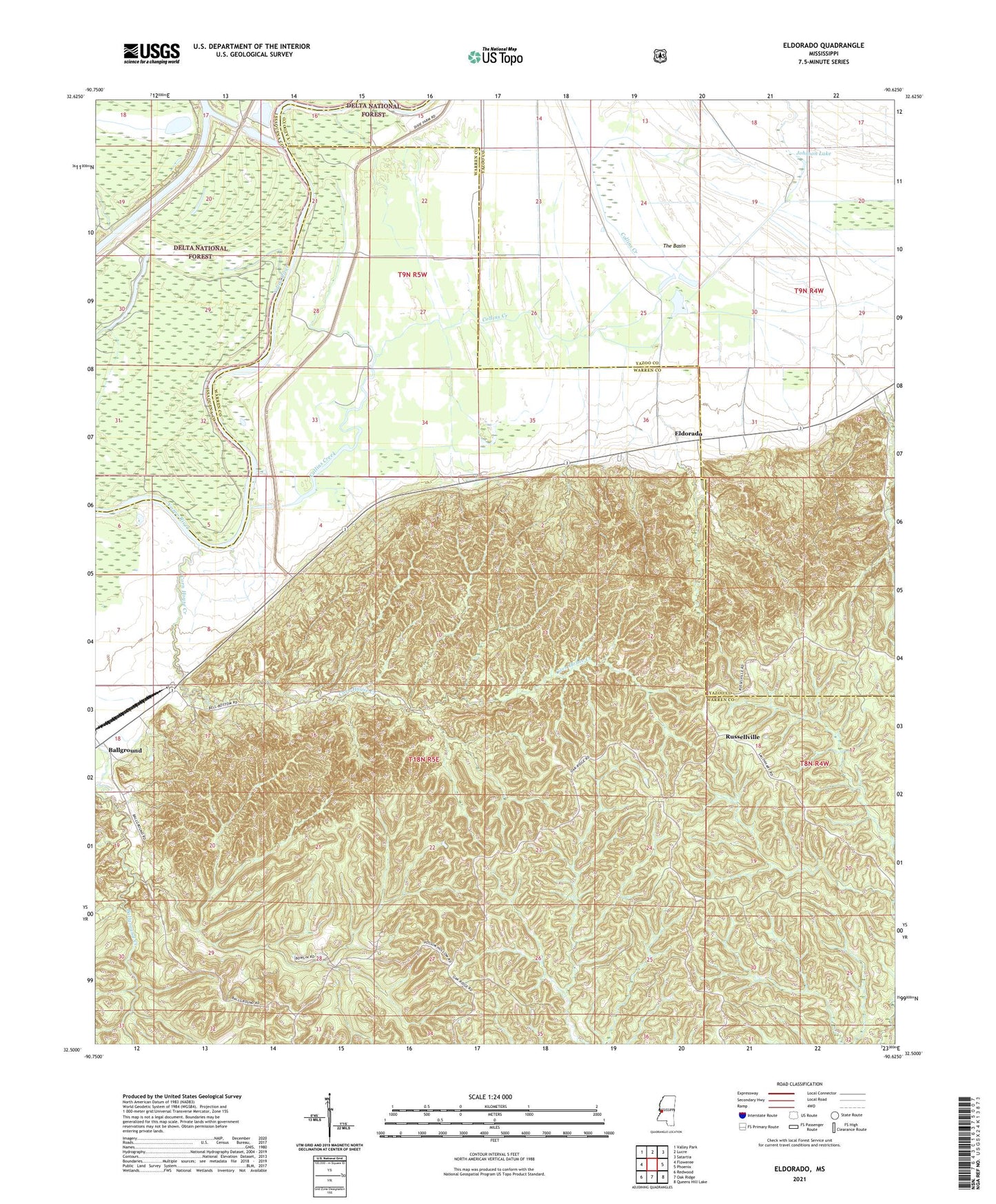
Eldorado Mississippi US Topo Map
Couldn't load pickup availability
Also explore the Eldorado Forest Service Topo of this same quad for updated USFS data
2024 topographic map quadrangle Eldorado in the state of Mississippi. Scale: 1:24000. Based on the newly updated USGS 7.5' US Topo map series, this map is in the following counties: Warren, Yazoo, Issaquena. The map contains contour data, water features, and other items you are used to seeing on USGS maps, but also has updated roads and other features. This is the next generation of topographic maps. Printed on high-quality waterproof paper with UV fade-resistant inks.
Quads adjacent to this one:
West: Floweree
Northwest: Valley Park
North: Lucre
Northeast: Satartia
East: Phoenix
Southeast: Queens Hill Lake
South: Oak Ridge
Southwest: Redwood
This map covers the same area as the classic USGS quad with code o32090e6.
Contains the following named places: Adams Landing, Ballground, Bradley Chapel, Church of Christ, Collins Bayou Landing, Collins Creek, Cooks Lake, Corn House Creek, Eldorado, Eldorado Landing, Johnson Lake, Lynch Chapel, Mount Zion Church, Oakland Chapel, Pleasant Valley Church, Purvis Landing, Russellville, The Basin