MyTopo
Tinsley Mississippi US Topo Map
Couldn't load pickup availability
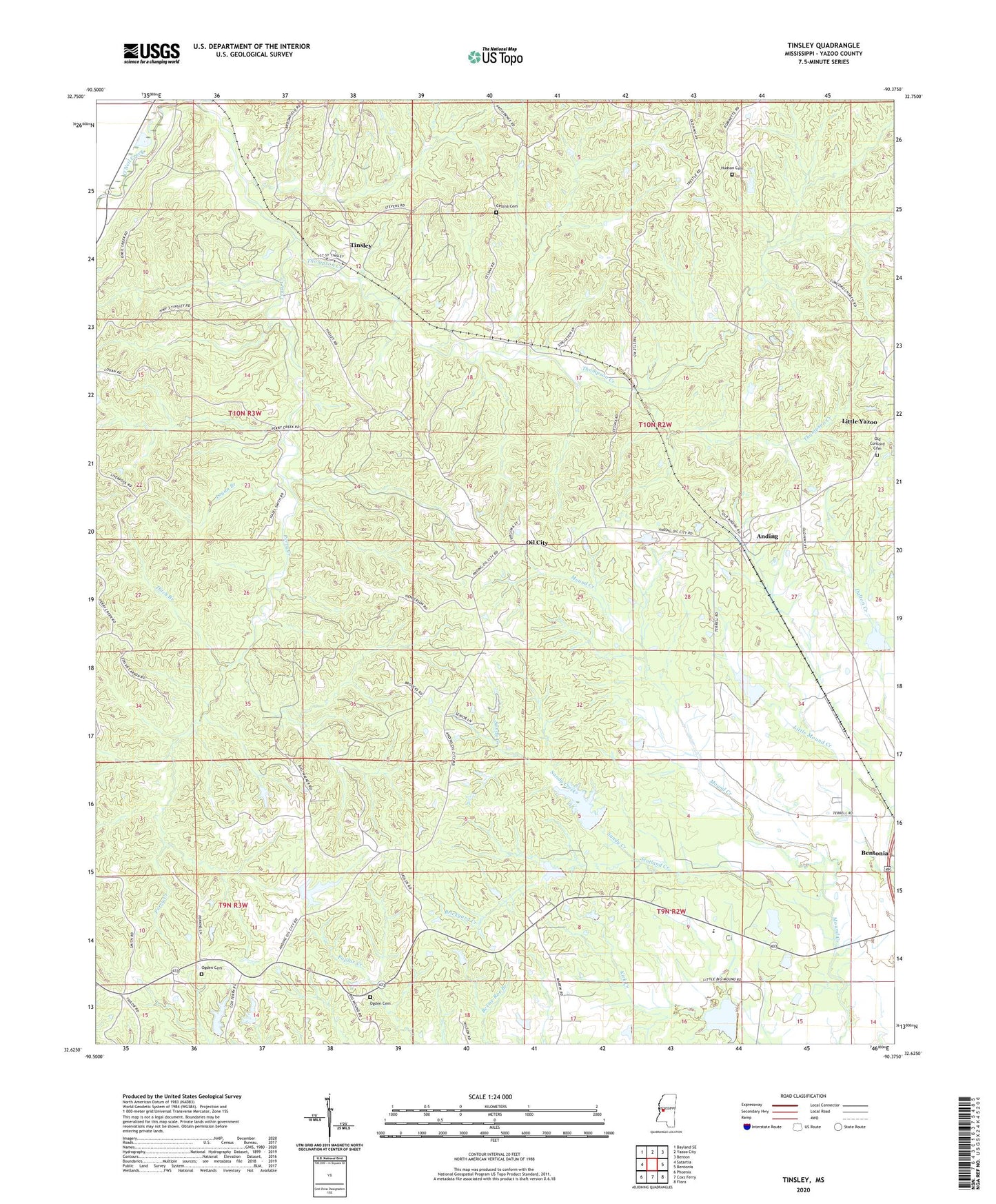
2024 topographic map quadrangle Tinsley in the state of Mississippi. Scale: 1:24000. Based on the newly updated USGS 7.5' US Topo map series, this map is in the following counties: Yazoo. The map contains contour data, water features, and other items you are used to seeing on USGS maps, but also has updated roads and other features. This is the next generation of topographic maps. Printed on high-quality waterproof paper with UV fade-resistant inks.
Quads adjacent to this one:
West: Satartia
Northwest: Bayland SE
North: Yazoo City
Northeast: Benton
East: Bentonia
Southeast: Flora
South: Coxs Ferry
Southwest: Phoenix
This map covers the same area as the classic USGS quad with code o32090f4.
Contains the following named places: Anding, Bentonia Gibbs Elementary School, Bentonia Watershed Structure 1 Dam, Bentonia Watershed Structure 2 Dam, Bentonia Watershed Structure 3 Dam, Bentonia Watershed Structure 4 Dam, Bentonia Watershed Structure 5 Dam, Bentonia Watershed Structure 7 Dam, Bill Link Pond Dam, Brickyard Creek, Cessna Cemetery, Chethams, Concord Church, Ditch Branch, Hudson Cemetery, Lewis School, Logan Branch, Mount Ever Church, New Concord Church, New Pleasant Grove Church, Ogden Cemetery, Ogden Church, Oil City, Old Concord Church, Perry Chapel, Perry Creek, Providence Church, Ralph Fears Lake Dam, Saint Paul Church, Sandy Creek, Scotland Creek, Supervisor District 1, Thompson Creek, Tinsley, Tinsley Baptist Church, Tinsley Oil Field, Tinsley Post Office, V W Landen Pond Dam, Woodbine Plantation, ZIP Code: 39040