MyTopo
Shannon Mississippi US Topo Map
Couldn't load pickup availability
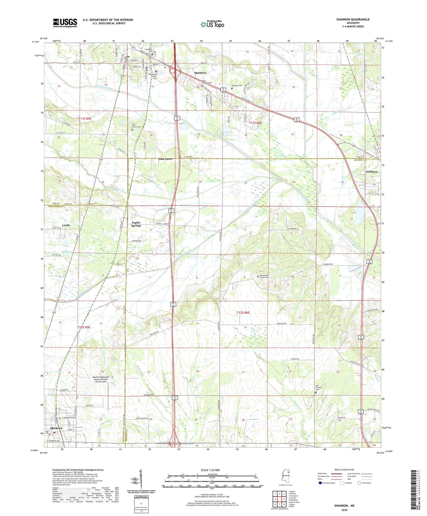
2020 topographic map quadrangle Shannon in the state of Mississippi. Scale: 1:24000. Based on the newly updated USGS 7.5' US Topo map series, this map is in the following counties: Monroe, Lee, Chickasaw. The map contains contour data, water features, and other items you are used to seeing on USGS maps, but also has updated roads and other features. This is the next generation of topographic maps. Printed on high-quality waterproof paper with UV fade-resistant inks.
Quads adjacent to this one:
West: Troy SE
Northwest: Bissell
North: Verona
Northeast: Evergreen
East: Nettleton
Southeast: Wren
South: Egypt
Southwest: Buena Vista
Contains the following named places: Bertersville, Black Oak Church, Blackwell Church, Blackwood Grove Baptist Church, Blackwood Grove Cemetery, Calvary Baptist Church, Camargo, Camargo Ferry, Chickasaw Switch, Chiwapa Creek, Church of God of Prophecy, City of Okolona, Coonewah Creek, Doty Chapel Cemetery, Dotys Chapel, Family Baptist Church, First Baptist Church of Shannon, First Christian Church, Johnsons Chapel, Leotis, New Prospect Cemetery, New Prospect Church, North Gatlin Street Church of Christ, Okolona Fire Department, Okolona First Baptist Church, Okolona Municipal Airport-Richard Stovall Field, Okolona Police Department, Pine Grove, Pine Grove Baptist Church, Pine Grove Cemetery, Poplar Springs, Poplar Springs Methodist Church, Saint John Missionary Baptist Church, Saint Theresa Catholic Church, Shannon, Shannon Cemetery, Shannon Elementary School, Shannon Fire and Rescue, Shannon Methodist Church, Shannon Police Department, Shannon Post Office, Shannon School, Smith Creek, Tallabinnela Creek, Temple Grove Church, Temples Cemetery, Town of Shannon, Tubbalubba Creek, Whiteside Family Cemetery, Willgo Creek