MyTopo
Bissell Mississippi US Topo Map
Couldn't load pickup availability
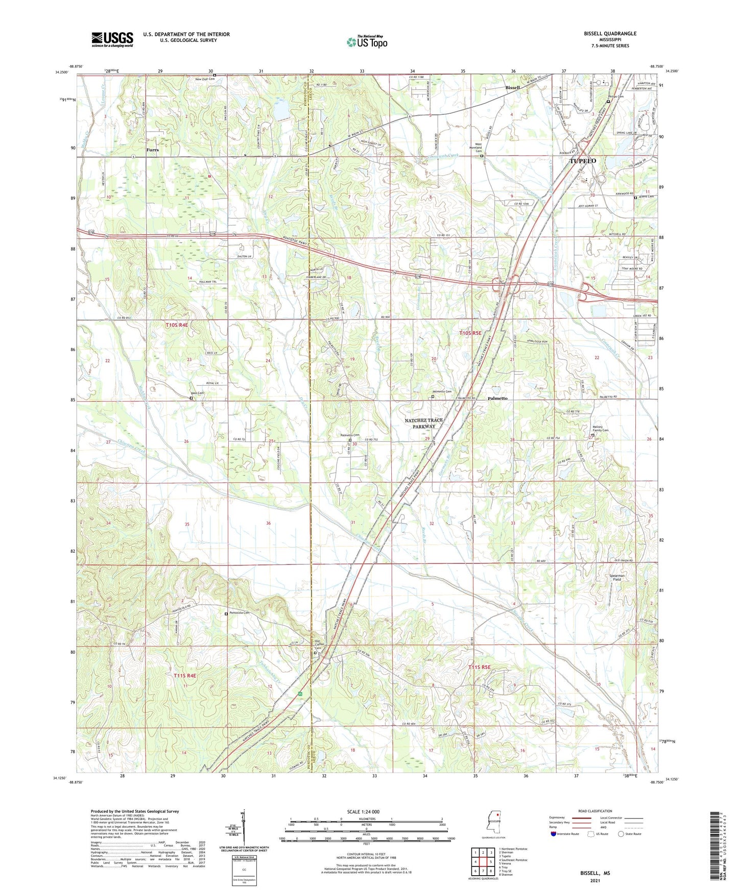
2024 topographic map quadrangle Bissell in the state of Mississippi. Scale: 1:24000. Based on the newly updated USGS 7.5' US Topo map series, this map is in the following counties: Lee, Pontotoc. The map contains contour data, water features, and other items you are used to seeing on USGS maps, but also has updated roads and other features. This is the next generation of topographic maps. Printed on high-quality waterproof paper with UV fade-resistant inks.
Quads adjacent to this one:
West: Southeast Pontotoc
Northwest: Northeast Pontotoc
North: Sherman
Northeast: Tupelo
East: Verona
Southeast: Shannon
South: Troy SE
Southwest: Troy
This map covers the same area as the classic USGS quad with code o34088b7.
Contains the following named places: Allens Cemetery, Ballard Park, Bass Cemetery, Big Hill Methodist Church, Bissell, Bissell Baptist Church, Black Land School, Blackland Church, Cedar Cove, Chiwapa Struture 29 Dam, Coonewar, Country Oak Estates, Dry Creek, Fawn Meadows, Fellowship Church, Fred Anderson Dam, Furrs, Furrs Baptist Church, Furrs Volunteer Fire Department, Galilean Baptist Church, Garmons Mill, Gormans Branch, Haven Acres, League Creek, Little Coonewah Creek, Mallory Family Cemetery, Metcalf School, Miller Creek, Mubby Creek, Natchez Trace Parkway, New Zion Cemetery, Oak Valley Church, Old Coffee Cemetery, Palmetto, Palmetto Baptist Church, Palmetto Cemetery, Palmetto Church, Palmetto Estates, Palmetto Methodist Church, Palmetto School, Philips Cemetery, Pontocola, Pontocola Cemetery, Pontocola Church, Pontocola School, Praise Acres, Reeds Branch, Spearman Field, Spring Lake Dam, Supervisor District 4, Tranquil School, Valley Grove Church, West Moreland Cemetery, Woodland School, Zion Church, ZIP Code: 38801