
MyTopo
Egypt Mississippi US Topo Map
Couldn't load pickup availability
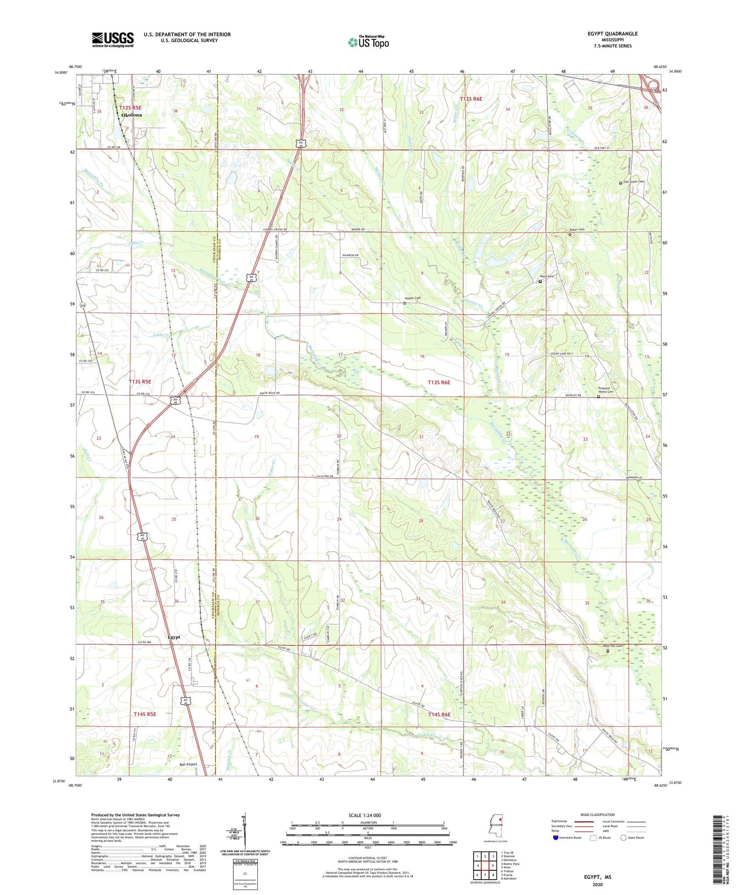
2024 topographic map quadrangle Egypt in the state of Mississippi. Scale: 1:24000. Based on the newly updated USGS 7.5' US Topo map series, this map is in the following counties: Monroe, Chickasaw. The map contains contour data, water features, and other items you are used to seeing on USGS maps, but also has updated roads and other features. This is the next generation of topographic maps. Printed on high-quality waterproof paper with UV fade-resistant inks.
Quads adjacent to this one:
West: Buena Vista
Northwest: Troy SE
North: Shannon
Northeast: Nettleton
East: Wren
Southeast: Aberdeen
South: Prairie
Southwest: Trebloc
This map covers the same area as the classic USGS quad with code o33088h6.
Contains the following named places: Baker Cemetery, Black Belt, Chapel Grove Baptist Church, Church of God in Christ, Darden Chapel Baptist Church, Egypt, Egypt Baptist Church, Egypt Hedgerow College, Egypt High School, Egypt Mennonite School, Egypt United Methodist Church, Goose Pond, Hales Lake Dam, Johnson Creek, Jolly Creek, Leftwich School, Leuth Flying Service Airport, Little Creek, Massey Creek, Mennonite School, Miller Creek, New Hebron Missionary Baptist Church, Old Union Cemetery, Pleasant Valley Cemetery, Pleasant Valley Church, Sadler Creek, Sloan Creek, Union Presbyterian Church, Walker Cemetery, Ware Hill Cemetery, Word Cemetery, Word Creek


