MyTopo
Smyrna Mississippi US Topo Map
Couldn't load pickup availability
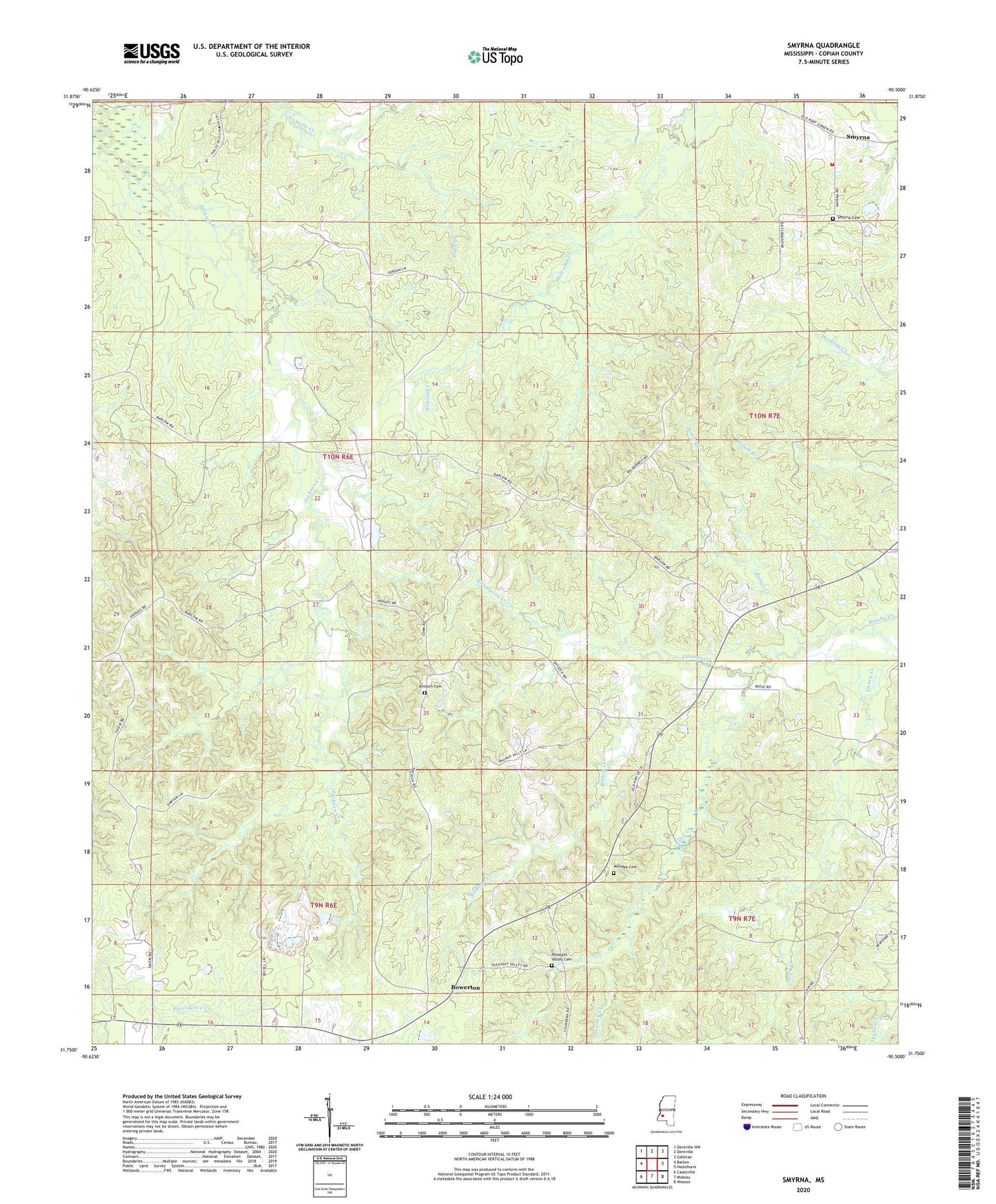
2020 topographic map quadrangle Smyrna in the state of Mississippi. Scale: 1:24000. Based on the newly updated USGS 7.5' US Topo map series, this map is in the following counties: Copiah. The map contains contour data, water features, and other items you are used to seeing on USGS maps, but also has updated roads and other features. This is the next generation of topographic maps. Printed on high-quality waterproof paper with UV fade-resistant inks.
Quads adjacent to this one:
West: Barlow
Northwest: Dentville NW
North: Dentville
Northeast: Gallman
East: Hazlehurst
Southeast: Wesson
South: Midway
Southwest: Caseyville
Contains the following named places: Antioch Baptist Church, Antioch Cemetery, Bishop Creek, Bowerton, Browns Wells, Hall Hill Church, Jackson Creek, Kaywood Plantation, Kaywood Plantation Airport, Kaywood Plantation Lake Dam, Millsaps Cemetery, Mount Olive Church, New Zion Church, Pineleaf Church, Pleasant Valley Cemetery, Pleasant Valley Church, Potter Creek, Saint Morris Church, Smyrna, Smyrna Baptist Church, Smyrna Cemetery, Smyrna Volunteer Fire Department, Supervisor District 3, Thompson Creek, Valley Creek, Wilderness Church