MyTopo
Midway Mississippi US Topo Map
Couldn't load pickup availability
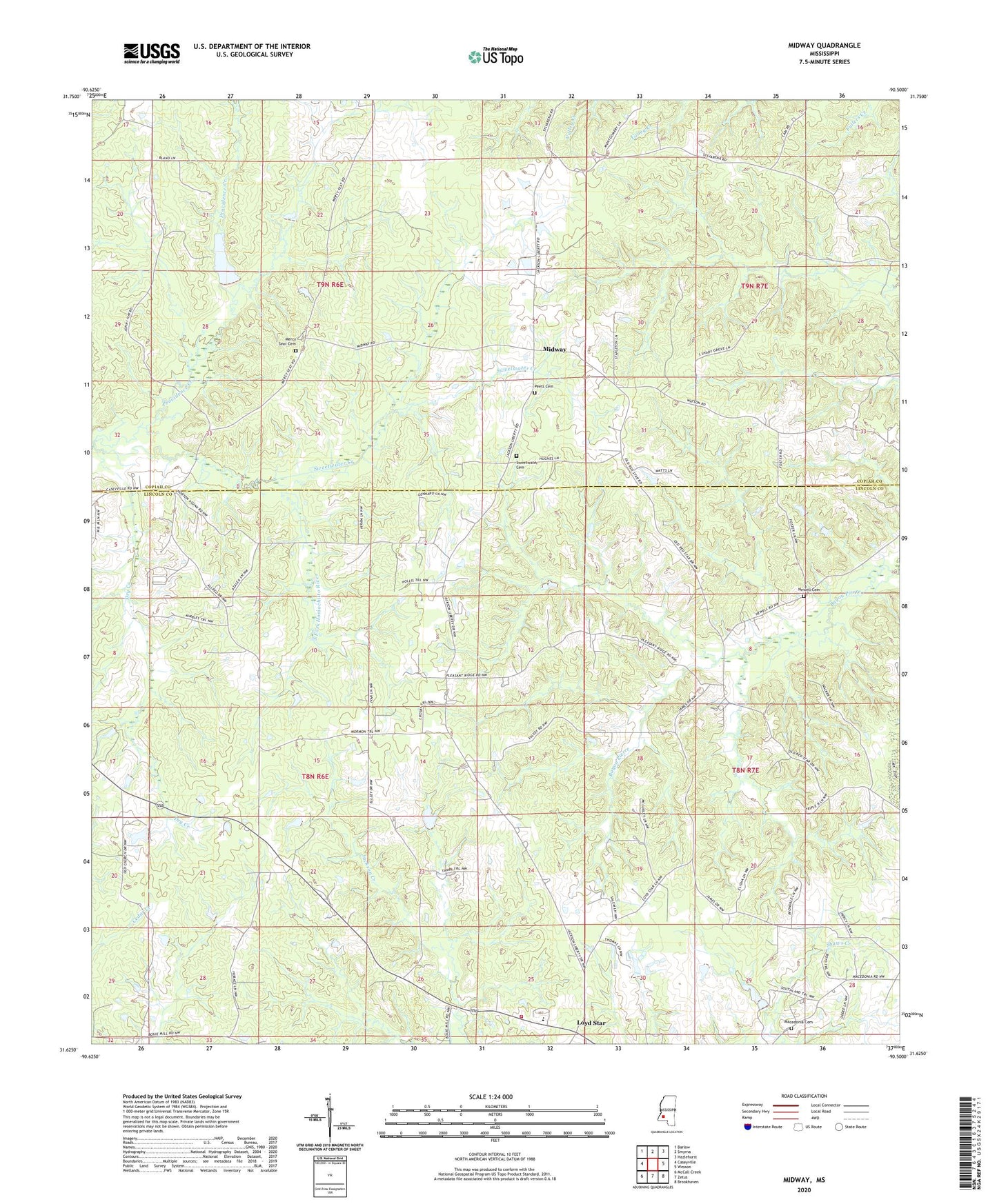
2024 topographic map quadrangle Midway in the state of Mississippi. Scale: 1:24000. Based on the newly updated USGS 7.5' US Topo map series, this map is in the following counties: Lincoln, Copiah. The map contains contour data, water features, and other items you are used to seeing on USGS maps, but also has updated roads and other features. This is the next generation of topographic maps. Printed on high-quality waterproof paper with UV fade-resistant inks.
Quads adjacent to this one:
West: Caseyville
Northwest: Barlow
North: Smyrna
Northeast: Hazlehurst
East: Wesson
Southeast: Brookhaven
South: Zetus
Southwest: McCall Creek
This map covers the same area as the classic USGS quad with code o31090f5.
Contains the following named places: Boys Club Lake Dam, Dry Creek, Garland Brookline Lake Dam, Goodman School, Grafton Hall School, I O Smith Lake Dam, Jericho Church, Latter Day Saints Church, Lloyd Hall School, Lloyd Star Consolidated School, Loyd Star, Loyd Star Volunteer Fire Department, Macedonia Cemetery, Macedonia Church, Mercy Seat Cemetery, Mercy Seat Church, Midway, Mount Pisgah Church, Mount Salem Church, Mount Zion Church, New Hope Church, Newell Cemetery, Old Red Star, Peets Cemetery, Pleasant Ridge Church, Providence Creek, Reed School, Searchlight School, South Fork Homochitto River, Sweetwater Cemetery, Sweetwater Church, Sweetwater Creek