MyTopo
Sunflower Mississippi US Topo Map
Couldn't load pickup availability
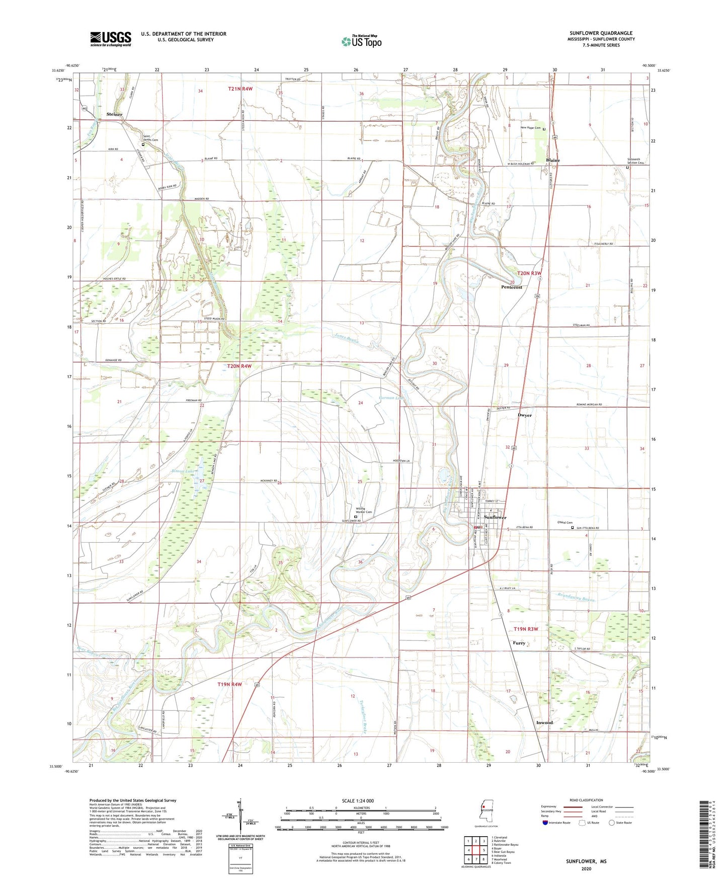
2020 topographic map quadrangle Sunflower in the state of Mississippi. Scale: 1:24000. Based on the newly updated USGS 7.5' US Topo map series, this map is in the following counties: Sunflower. The map contains contour data, water features, and other items you are used to seeing on USGS maps, but also has updated roads and other features. This is the next generation of topographic maps. Printed on high-quality waterproof paper with UV fade-resistant inks.
Quads adjacent to this one:
West: Boyer
Northwest: Cleveland
North: Ruleville
Northeast: Rattlesnake Bayou
East: Bear Gut Bayou
Southeast: Colony Town
South: Moorhead
Southwest: Indianola
Contains the following named places: Bear Bayou, Bearden Brothers Pond Dam, Binson Lake, Blaine, Blaine Baptist Church, Blaine Methodist Church, Blaine School, Church of God, Duncan Chapel, Dwyer, East Sunflower School, Furry, Gorman Lake, Inwood, Jacob Chapel, Jones Bayou, Kates School, King Solomon Church, King Solomon School, McKinney Chapel, Mount Carey Church, New Hope Baptist Church, New Hope Cemetery, New Macedonia Church, Oak Grove Church, O'Neal Cemetery, Pentecost, Persimmon Grove Church, Pine Land, Roundaway, Roundaway Church, Roundaway School, Saint James Cemetery, Saint James Church, Saint Johns Chapel, Saint Johns School, Saint Peters Church, Sixteenth Section Cemetery, Sixteenth Section School, Steiner, Sunflower, Sunflower County, Sunflower Police Department, Sunflower Post Office, Sunflower Town Fire Department, Supervisor District 3, Supervisor District 4, Town of Sunflower, Turner Arant Pond Dam, Union Grove Church, Willing Worker Cemetery, ZIP Code: 38778