MyTopo
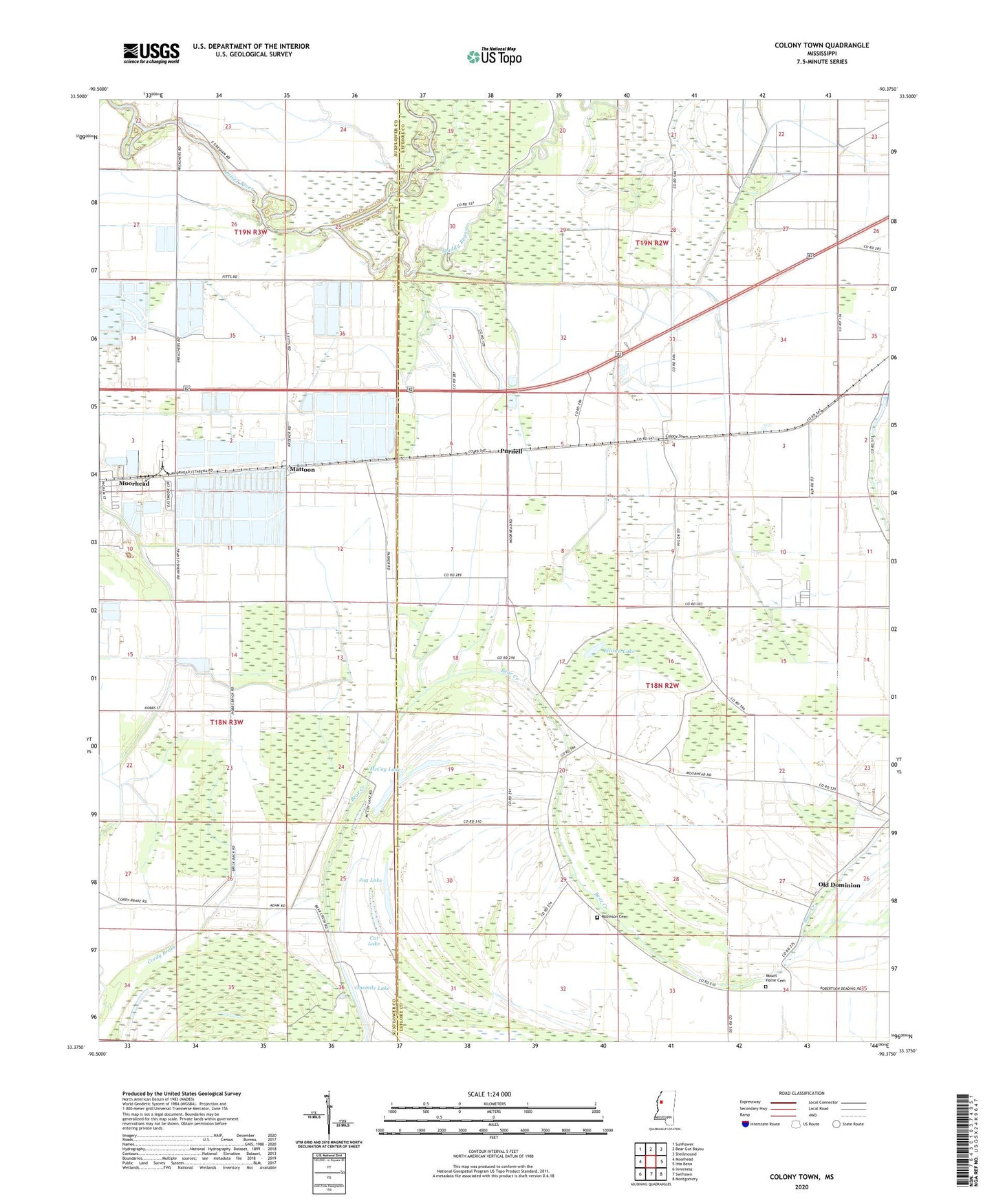
Colony Town Mississippi US Topo Map
Couldn't load pickup availability
2024 topographic map quadrangle Colony Town in the state of Mississippi. Scale: 1:24000. Based on the newly updated USGS 7.5' US Topo map series, this map is in the following counties: Leflore, Sunflower. The map contains contour data, water features, and other items you are used to seeing on USGS maps, but also has updated roads and other features. This is the next generation of topographic maps. Printed on high-quality waterproof paper with UV fade-resistant inks.
Quads adjacent to this one:
West: Moorhead
Northwest: Sunflower
North: Bear Gut Bayou
Northeast: Shellmound
East: Itta Bena
Southeast: Montgomery
South: Swiftown
Southwest: Inverness
This map covers the same area as the classic USGS quad with code o33090d4.
Contains the following named places: Adams Lake Dam, Cat Lake, Colony Town, Cordy Brake, Delta Processing Pond Dam, Delta State Junior College, Ellison Lake, Fitts Brothers Lake Dam, Green Grove Church, Hobbs Airport, Jug Lake, Kroeker Lake Dam, Mattoon, McCoy Lake, Moorhead Lagoon Dam, Morgan Chapel, Mount Home Cemetery, Mount Maria Church, Muddy Bayou, Old Dominion, Onemile Lake, Purnell, Robinson Cemetery, Taylor Lake Dam, Trans Fisheries Incorporated Pond Dam, Watson Lake Dam, ZIP Code: 38761