MyTopo
Tocowa Mississippi US Topo Map
Couldn't load pickup availability
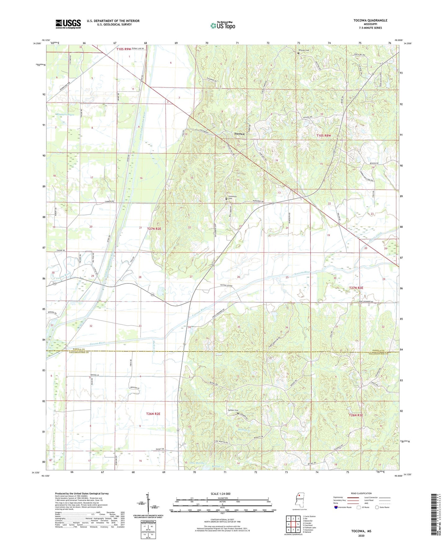
2020 topographic map quadrangle Tocowa in the state of Mississippi. Scale: 1:24000. Based on the newly updated USGS 7.5' US Topo map series, this map is in the following counties: Panola, Tallahatchie. The map contains contour data, water features, and other items you are used to seeing on USGS maps, but also has updated roads and other features. This is the next generation of topographic maps. Printed on high-quality waterproof paper with UV fade-resistant inks.
Quads adjacent to this one:
West: Crowder
Northwest: Curtis Station
North: Asa
Northeast: Batesville
East: Courtland
Southeast: Oakland
South: Charleston
Southwest: Fishhook Lake
Contains the following named places: Antioch Church, Bethel Church, Bradley School, Buntyn Creek, Centerhill Cemetery, Centerhill Church, Independence Church, Independence School, Jackson Cemetery, Jackson Grove Church, Jackson Grove School, Mount Pleasant School, Peters Creek, Pharsalia, Pharsalia Church, Pharsalia School, Pleasant Grove Church, Pleasant Grove School, Popular Springs Church, Rayburn Bayou, Robina, Rosewall School, Shelton Creek, Shiloh Baptist Church, Springfield School, Supervisor District 3, Sutton Lake, Tocowa, Tocowa Church, Whitten Cemetery, Willow Spring Church, Yocona River, ZIP Code: 38927